Strangers on a Train

Daily writing prompt
Describe a random encounter with a stranger that stuck out positively to you.

In my experience, there is no better place to enjoy an encounter with a stranger and hold an interesting conversation than on a long-distance train. Amtrak is particularly conducive to this experience because of their open seating policy in the dining cars. As a single traveler, I am usually the third or fourth person at a table and seated with random strangers. We obviously have something in common — we are travelers in what is a moving community of several hundred people. Where are we going? Where are we from? We exchange names. We explore each other’s stories. I have met so many interesting fellow travelers. Many come to mind, but a few stand out.

Once I was seated first at a table for four, so I was waiting for others to be seated at my table. Soon the door opened and a huge black man, possibly 300 pounds, entered the dining car. From my vantage point I could see the ripple of animated concern at the few tables with one open space. He was seated at my table, taking up most of one side, and we immediately began a conversation over the menu and ordering our food. He turned out to be a cinematographer and a local live theater director/producer.  He was on a long-distance rail trip (to help a friend) and was using the time to document the stories and experiences of other travelers. I ended up being interviewed on video for his project. I left him at Kansas City, but he still had another day and night ahead of him. It was a most enjoyable encounter. 

On another trip, I was seated at a table across from a woman who lived on the island of Hawaii. Since I had never been there, we talked about the various birds and flowers she had in her yard and what her little community was like. During our conversation, I noticed that a woman at the table across the aisle was paying close attention. Finally, she interrupted and asked where my table companion lived. They turned out to be neighbors, living a couple blocks apart. Somehow, they both left Hawaii on different days heading to different destinations and ended up on the same train in the dining car in the middle of New Mexico. Synchronicity, once again, rears its head — Karl Jung would be impressed.

I have had similar encounters with National Park Rangers, young writers, a “Ghost Writer” who could not divulge her client’s name, an elderly mother-daughter pair on their first trip to the Grand Canyon, a commercial beekeeper, and a local amateur historian from Osawatomie, Kansas. Osawatomie was the town where John Brown based his 1850s anti-slavery campaign and my fellow traveler knew all about the “Bleeding Kansas” stories. Long-distance train travel is always interesting. People are generally relaxed and open to conversation.

Where I Lost my Hat.

I spent the afternoon bushwhacking at Ojito near the bike trails. I explored some low cliffs along what seems to be a former stream bed, now dry.  A rough location approximation is HERE on Google maps. You will see sort of a diamond shaped sloping mesa with a low cliff to the south and a higher one to the north. The rock seems to mostly be sandstone but mixed and very pock-marked in places. It doesn’t look like much as you approach the lower edge (south).

Click on these pictures for full size.

The cattle tracks will lead to an easy way up over the low cliff to the sloping top of the mesa.

This is a slab of rock that is about table sized that apparently fell from the top of the low sandstone cliff. It is too big to move.

There are fossils of something —  maybe crinoid or maybe vertebrae. There are other undefinable fossils. Since this was the floor of the inland sea, I’m guessing crinoid shafts. There are two or maybe three traces. (Click to enlarge.)

As often happens, I will stumble upon something that is very odd. This time it is a very peculiar jointed/cracked section of exposed bedrock. It looks like mud or silt that curled up when dried after a wet period. 

The rectangular sections are maybe 15-20 inches to a side, much larger than typical mud flakes. It looks like a natural tiled floor surface. I have never seen that type of jointing and cracking of bedrock before. 

It takes a while to walk up hill to the northern edge and the higher cliff face on the north edge. That is where I lost my hat — a wind gust took it over the edge of the cliff. No way to get it. It was a good hat.

Anyway, while sitting on a rock and moping about my hat I found what I think will turn out to be a conical spiral shell fossil. It is only partly exposed but it looks promising. 

The view from the top is impressive…

I ran out of time so headed back home but the area looks interesting. The main road climbs up a slope some distance to the south and may top out a half mile along on the same rock strata as the top of the cliff.

     *     *     *     


High Desert Winter

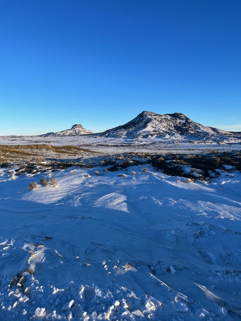
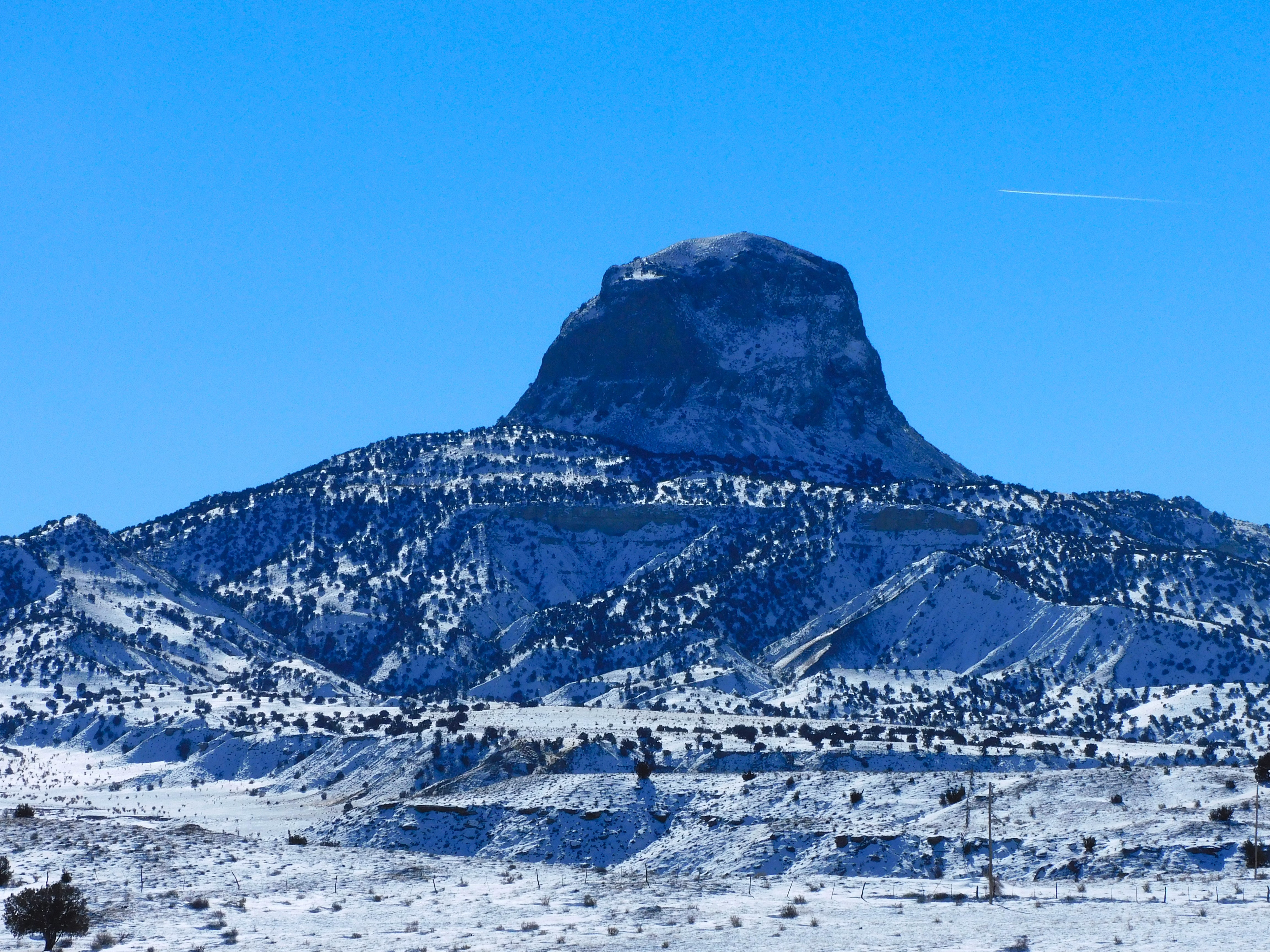
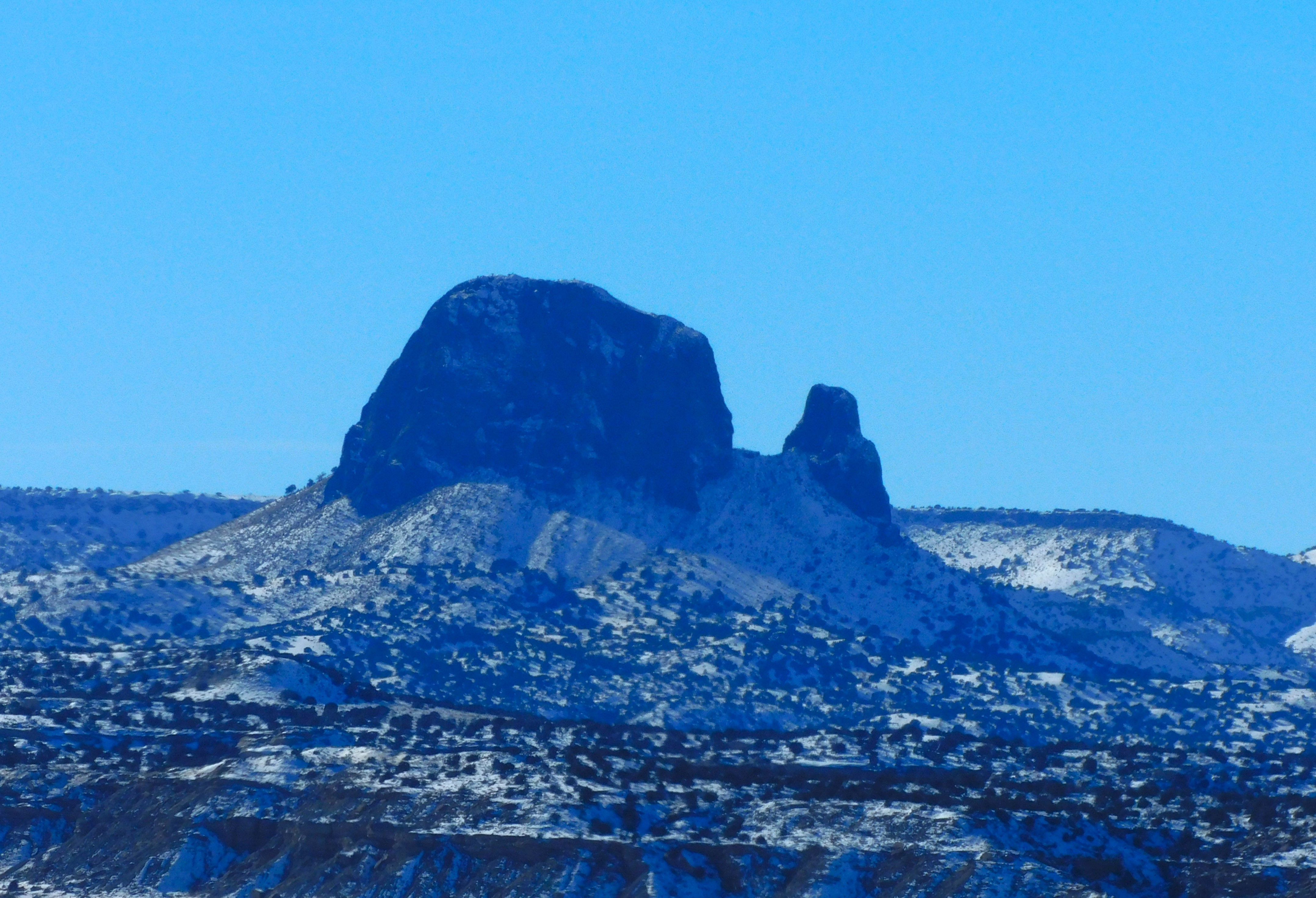
A cold day in the New Mexico outback — near Cabezon Peak

DSCN7356xy

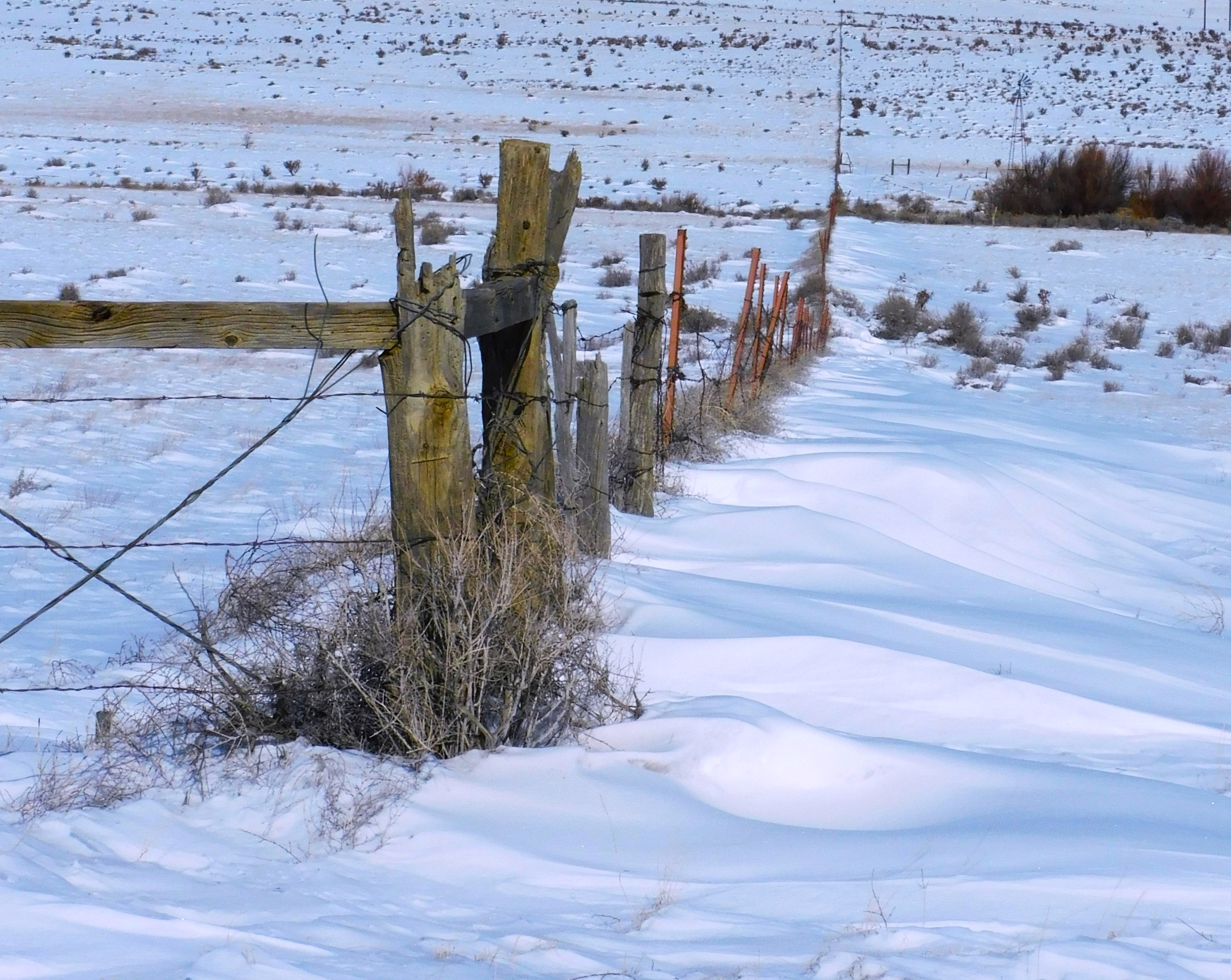
Temperature maxed out at about 27 F. Windy. Sunny. A little treacherous. Not too bad

DSCN7360xy

IMG_1859

Cabezon and Cerro Cuate

DSCN7357xx

Cabezon Peak

DSCN7367x

Cerro de Guadalupe

This is part of the Mount Taylor volcanic field (Rio Puerco Volcanic Necks).  Eruptions between 4 and 1.5 million years ago.

     *     *     *

The Home Place – 2024

Spare Time Prospecting Along Cabresto Canyon in Northern New Mexico

IMG_1016x

I spent a week up at Red River, NM — high up in the Sangre de Cristo Mountains. My intention was to spend my time fishing the Red River and the Cimarron River — and any other spots I could find. One thing that is awkwardly noticeable as you approach Red River from the west (via Cuesta) is the humongous Molybdenum mine — Moly for short. No one can pronounce Molybdenum accurately more than once so Moly is the term of choice.  The mine is an open pit but you can’t actually see into it because of the huge tailing piles along the highway. Those waste piles have leached acidic drainage into the Red River and made it a dead zone for many years. It is now a Super Fund site, and it is coming back over time. The fish in that stretch of the river fled or died out but I saw some people fishing there so maybe it is supporting natural and healthy flora and fauna in the stream, which will support the fish.  Anyway…this epistle is not about fishing but rather mining.

A Rockhound friend came up to visit for a couple days and we went off to explore the backcountry mining district in Cabresto Canyon. Why there? It was a little out of town and not very busy. The Red River mining district goes back over the 175 years that it has been in the US and perhaps a couple hundred years before that. It was noted for gold, silver, lead, copper, moly, and a number of other ores. Mining continued in the area until recently and some mines are still active.

RED RIVER MINES

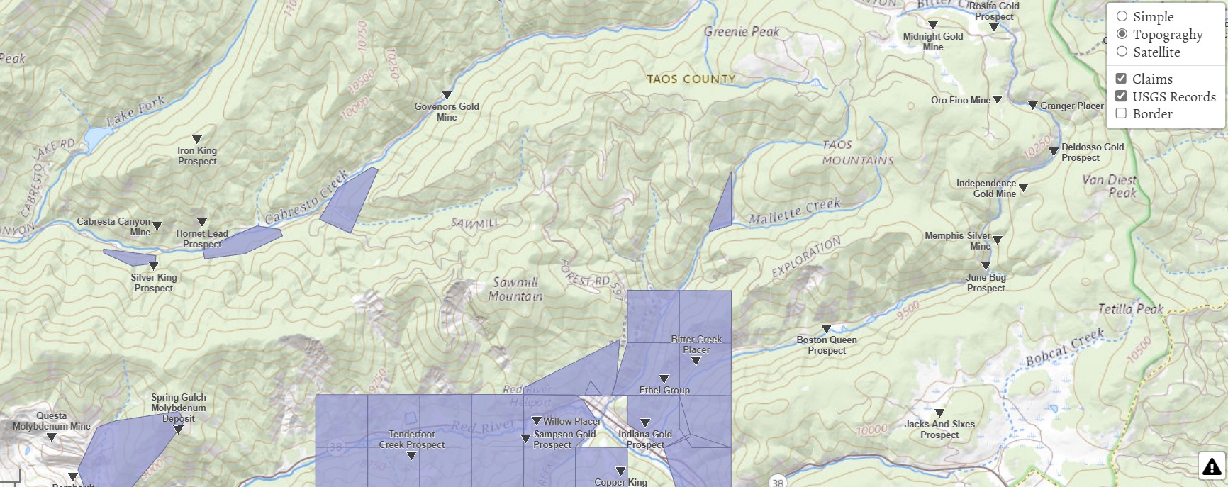
USGS map found on thediggings.com website.

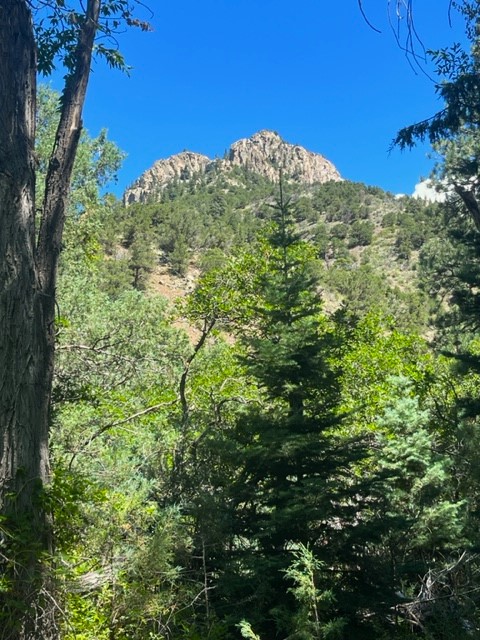
There are several hundred inactive mining claims in and around Red River — too many to show in the gray areas.  We followed the Cabresto Creek canyon drainage system from around 9,000 feet up to 10,700 feet in elevation and into the Bitter Creek area. We identified six mine sites. We found one unidentified mine located below Cabresto Lake, the Cabresto Canyon Mine, Hornet Lead Prospect, Silver King Prospect, The Governors Gold Mine (Spanish Main), the Midnight Gold Mine, and Cashier Gold Mine. The last two have been essentially cleared by the US Forest Service for environmental reasons. The others have identifiable tailings, prospect holes or shafts. Tailings piles of over 100-150 years old are largely overgrown. 

We had the benefit of flying photo-drone to gain some photographic views of the higher slopes and different angle perspectives on some of the mining sites. The actual mine shafts or diggings were often too far up the mountain slope for easy access.

DSCN6780

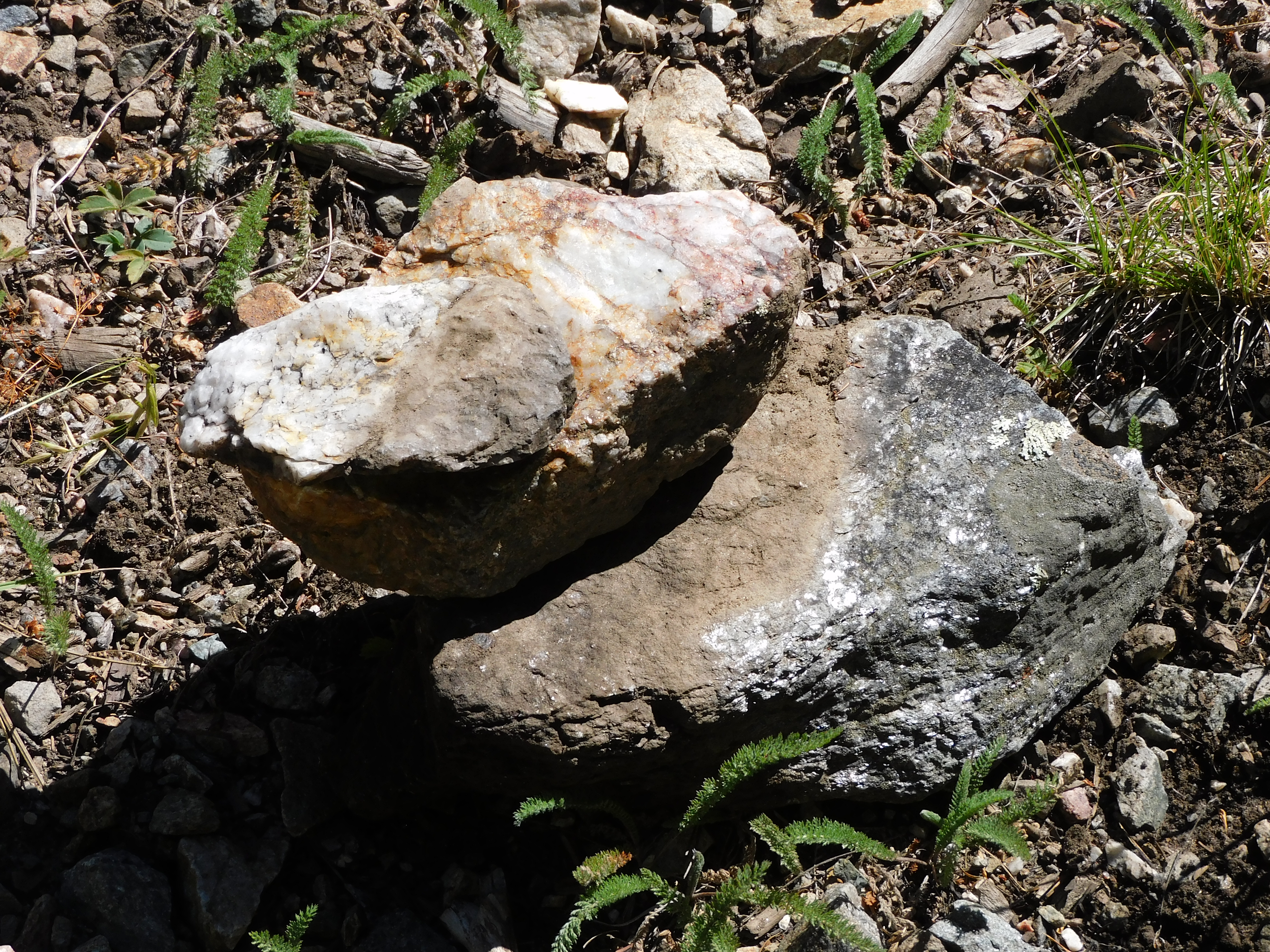
The area is either a geologist’s nightmare or a geologist’s heaven — depending on the intent and skill level. The wide variety of mineral content makes identification difficult. We found some ore that strongly reacted on a metal detector. Much of what we found had biotite mica inclusions, chalcopyrite and some interesting quartz, lead, and even tourmaline samples. Further identification will have to wait.

The Silver King Prospect seems to have been inactive and overgrown on a steep and ravined hillside. I have not found a date associated with the mine. We found some interesting surface mineral specimens and the site seems to be frequently visited by hikers. The Hornet and Cabresto mine sites were identifiable only due to some noticed tailing pile outcrops on the hillside. They do not seem much accessible beyond that.  The unidentified mine site was found by tailings, but the actual mine site is farther up the hill. This site was near the road and had a very broad range of rock and mineral types. Mica was most abundant.

IMG_0980x

The Governor’s Gold Mine is also known as the Spanish Main Prospect. The mine apparently dates back to the Spanish colonial period in the 1600s to the early 1800s. There is a mine shaft about 20 feet up off of the road that is enterable for some distance.  The story associated with the mine is that the early miners sent $10,000 each month to the Queen of Spain as a royal share of the mine’s output. That is hard to believe looking at it now. We found evidence of prospect holes and diggings and the metal detector reacted to a number of surface ore samples. It is hard to know when any of the visible activity evidence took place.

The Midnight Mine and Cashier Mine are close together in an open parklike area at almost 10,700 feet. The Midnight Gold Mine operated at a profit from about 1897 until 1900 when it was abandoned. There are photographs of a respectable the mining camp named Midnight City existing on the flat area just below the mine and there are some possible remnants of building foundations. The site is littered with nails. The associated mining camp and structures were left on the site and still evident in the 1960s. All of that, including the smelter and tailing piles have been removed and the shaft entrance filled in by the USFS. The townsite is now mostly a boggy wetland.

The Cashier mine has even less remaining of its active period. There are traces of old wagon tracks but not much else. The ghost towns have been hauled away or melted into the terrain.

We chose not to explore the mines closer in toward Red River but there are many and some apparently still have relics or structural evidence. That will be another year. Red River is a skiing and summer tourist town blessed or infected by Texans, depending on your point of view. The local entrepreneurs offer guided jeep tours into the mountains chock full of Texans of every age and gender. They scowled and did not seem to be enjoying themselves whenever we encountered them. The tourists also can rent an off-road vehicle and cruise through the unpaved and deeply rutted mountain roads at breakneck speed. Watch for oncoming careening Texans in off-road vehicles.

For more information on the general area look here…

Click to access Circular18.pdf

Click to access Scenic_Trip-02_Reprint.pdf

Wanna Get Away?

IMG_0827I have a couple comrades who like to get away into the New Mexico outback — like me — and we have been roaming through the Rio Puerco/Cabezon Peak area, went to a mining ghost town, a few other places in the Jemez Mountains, and in the east mountains. We did this recently before the heat made us suspend our adventures. One is a trained geologist — the  paleo kind. He is a profesional photographer with his own business. The other is an avid rock hound and scrounger of any interesting debris. He finds some amazing stuff. I’m a photographer and poet and like to ramble. I have an interest in history and some geology training.  Here are a few pictures of what we have been up to these past few months. I enjoy going solo a lot of times but at my age it is good to have someone along.

Golden Open Space Area — East Mountains

The east mountains are east of Albuquerque. They have names — the San Pedro’s, the Ortiz, the Cerillos Hills, and South Mountain, – a volcano.  There is gold in them thar hills and some working gold mines. The Ortiz Mountains had the first gold strike way back in the 1820s or so, while under Mexican control. There are many mines in the area, not just for gold. The town of Madrid was a coal mining town. The Cerillos Hills is where the Pueblo Indians mined turquoise for trade all the way to Yucatan.  The Golden Open Space area is a public area owned by the city of Albuquerque but quite distant.  There were no other visitors that day and the temperature was in the 90s. You can click on the photos for a larger view.

It was too hot to poke around as much as one would like. There are a few fossil seashell imprints, but it would seem that there would be more than that but didn’t get across the deep arroyo that day.

The Kelly Mine and Ghost Town

The mining district near Magdelena. New Mexico produced zinc ore and maybe six or more other profitable minerals including some silver and gold. The Kelly Mine operated from about 1880 into the 1920s, more or less, and mostly produced zinc ore. It is private but open for public access and still has some impressive mine structures, tailing piles, a few shafts, and a few standing walls and a cemetery from the old town. This is rock-hound heaven. We made the journey and spent most of a day roaming around the site. There were a few other visitors that joined us later in the day, but the site is mostly empty. The road leading to the place is a challenge. We found some interesting mineral specimen rocks including some “Fool’s Gold” and some zinc and quart.

We had the benefit of a drone so we could look around the hillsides and over the ridge to see what was accessible. The head frame was a nesting site for a family of crows who were not happy to see us or the drone.

Magdelena is a few miles down the road. There is not much there for visitors. There are other mines and ghost towns located to the north of town. That will be a future trip.

The Volcanoes — Petroglyph National Monument

Just immediately west of Albuquerque, on the west mesa, are several notable small volcanoes. Once upon a time, a five-mile crack opened and lava flowed out covering the mesa top. The crack became clogged in places and several smallish volcanoes erupted where the magma was still able to get through. The hard lava basalt covers the top of the mesa, but the volcanoes are a notable feature on the western horizon. It is a good place to hike and take photographs on a good day. The city and river valley are laid out below and the Sandia Mountains are directly across, holding up the east side of the Rio Grande Rift.

On our visit the Prickly Pear Cactus were in full bloom along with other wildflowers and a ringneck lizard joined the party by posing on a rock for a while.

In the ten years I have visited the volcanoes the Park Service has been gradually restricting access to certain areas. Visitors can still climb the middle volcano but not the other two. The area was a bit over used and is a fragile and easily damaged desert environment. The volcanoes also hold some sacred value to the local Pueblo Indians.

Shark Tooth Ridge

Shark Tooth Ridge is an ill-defined area noted for the presence of fossilized shark’s teeth out near the Puerco River and Cabezon Peak area. This is definitely the outback, and you can get lost out there if you try hard enough. It is not very easy to find and an hour or more west of Albuquerque.

This is part of the Mount Taylor Volcanic Field and there are dozens of old volcanoes and volcanic plugs. Cabezon Peak is the most prominent one and resembles Devil’s Tower in Wyoming but is a little larger. The last 15 miles are dirt roads and there are many to choose from — that is the challenge.  We found the place on our first try. Finding our way out was a little trickier.

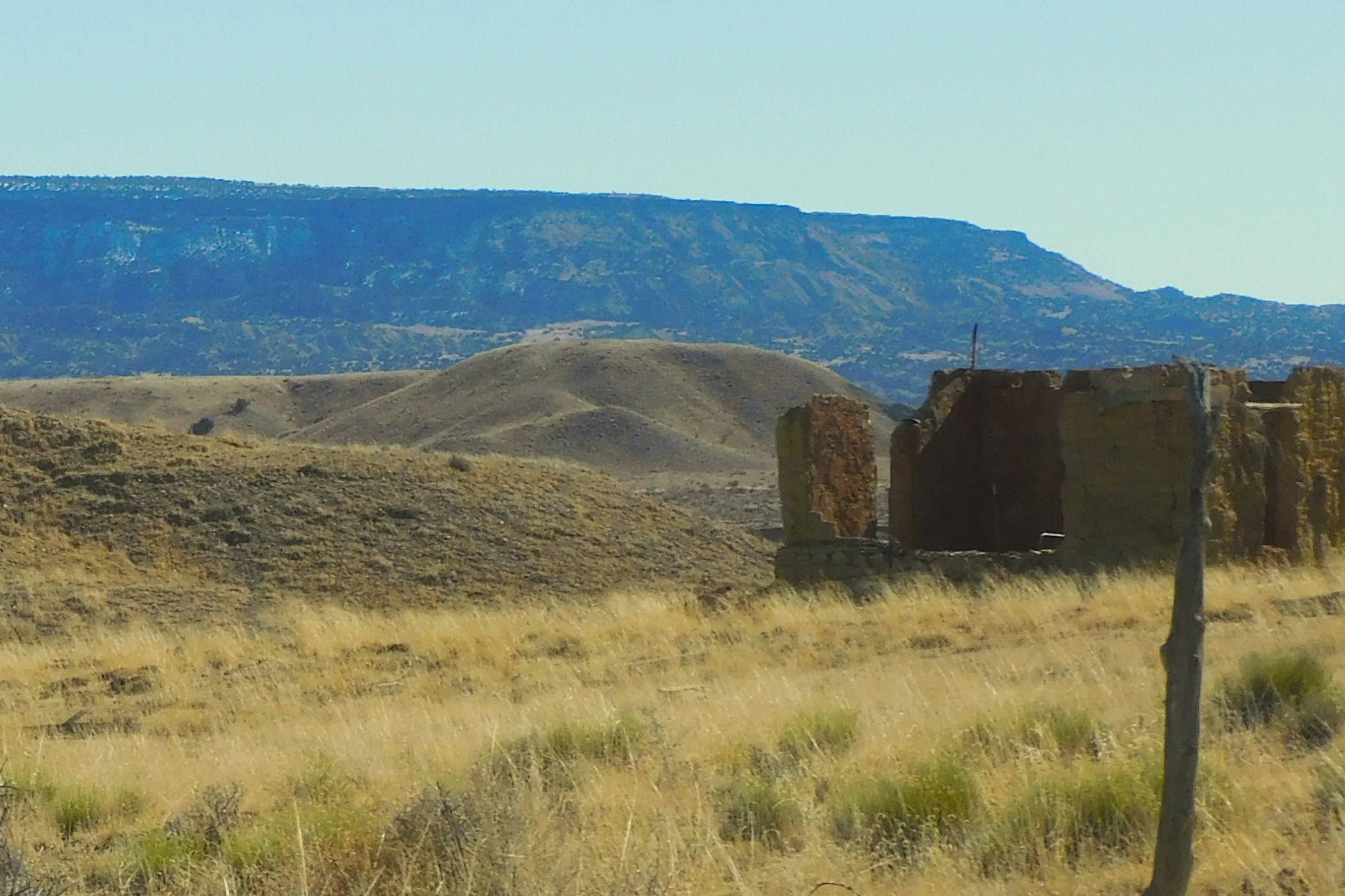
We searched for several hours but never found a shark’s tooth, but the geology is interesting and so is the scenery. It is curious being both volcanic and also seabed sedimentary mixed together.  Since our visit one of our team did find a couple shark’s teeth so they are out there. We will go back. There are a lot of photo ops and a number of wild horses that roam the area.  There are also a few homestead relics where someone tried to settle in the area.

DSCN6053x

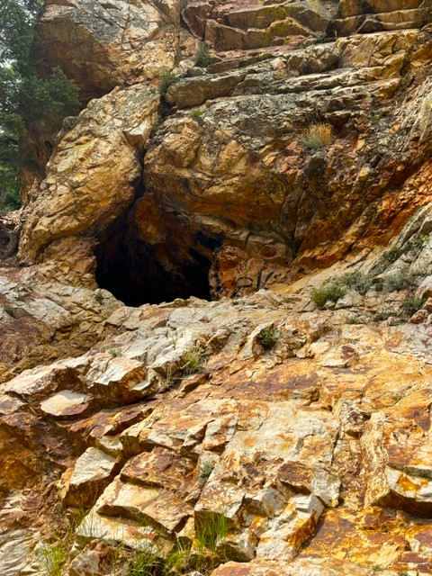
One thing I’ve noticed in the places we have been visiting is the lack of vandalism and “tagging” that you often see out in public spaces. That was especially true at the Kelly Mine where you might expect to see some vandalism.  Other places that we have visited, most notably the Gilman Tunnels, there is a lot of graffiti scrawled on certain areas. I guess people carry spray paint cans simply for the act of defacing public areas. I don’t get it.

Other places we have been visiting include the Gilman Tunnels and the Valles Caldera, both up in the Jemez Mountains, and the Hoodoos in the Ojito Wilderness. I have posted descriptions of those last three already.

     *     *     *

Carlsbad Caverns Trip

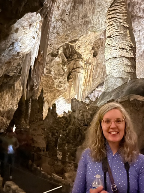
My daughter took me to Carlsbad Caverns for Fathers’ Day. I finally got to go — and I feel like I’m almost the last person who hasn’t seen it based on stories from friends. It is a wonder of wonders, just like they all said. Bear with me — it does involve photography.

Getting there has been the challenge for me over the ten years that I have lived in New Mexico. Even though it is in the same state, it is a 750-mile round trip journey from Rio Rancho to Carlsbad and it is not the most scenic route. A month ago, we had occasion to spend a weekend in Roswell, another new place for me, and it was a reasonable and enjoyable trip. We had a nice stay — so we figured that we could stay in Roswell again and make a day trip to Carlsbad – there and back. From here you go east on I-40 to Clines Corners. That is the roadside emporium where you can find almost any sort of tourist paraphernalia you want. Rubber tomahawk? You got it. Hat or Cowboy boots? Yep, pardner, right over there. A full cowhide? Sure, why not? Popcorn, peanuts, candy-coated snacks? You bet. Bathroom? Yessiree. The scenery was typical interstate up to that point. From there it was straight down highway 285 onto the high plains – let me emphasize straight. It is a better road than the interstate because nobody is on it. Dual highway straight to Roswell and then on south to Carlsbad.

People complain about the high plains as they drive the interstate. Off of the interstate it reveals a different character and timelessness. I like driving backroads through Kansas and this was similar but no corn or soybeans — just grass and cactus as far as the eye can see. off in the distance there might be a wind farm, then a windmill and a water tank surrounded by cattle. Then a lonely single-file parade of cattle going nowhere in a hurry — for what? You can see twenty miles ahead and behind and there isn’t anything to get you moving. There are occasional trees that offer shade for a half-dozen cows. The Antelope, that you occasionally see as well as the cattle, must browse the tree leaves and branches and open up space for the cattle. Mighty considerate.

You will pass through Encino after a while. You see it ahead because of the trees. It is mostly dead or dying as a town. Halfway to Roswell is Vaughn. You might have noticed the freight trains over on the left (east) at some distance. The railroad has a presence in Vaughn. I think it would be a ghost town otherwise.  You will be hungry and wanting to get out and stretch by the time you get to Vaughn, especially if you didn’t go into Cline’s Corners. Vaughn has Penny’s Diner — a retro shiny metal-sided recreation of the old diners of bygone days. It is part of the Travelodge that sits back behind it and part of a chain of diners associated with that motel. I had a classic BLT that was great. The manager/waitress/motel clerk/server/cashier was doing temporary duty in Vaughn in that capacity — shipped there by Travelodge for two weeks from Yuma, Arizona because there was nobody local in Vaughn who would or could do the job.  Somebody had to mind the store — the railroad crews seem to be local customers and were not going away. The freight line was pretty busy.

After our sojourn in Vaughn, we continued across the plains to Roswell. I think I talked about Roswell before. It hasn’t changed in the last month. We ate at a nice Mexican restaurant. The primary entertainment back at our hotel was the US-Mexico soccer game — a shitshow that was eventually ended a few minutes early due to Mexico vans’ bad behavior — shouting homophobic slurs and throwing stuff on the field. The US team won 3-0.

The road to Carlsbad is much the same except for oil wells instead of wind turbines. I wonder why? Artesia still smalls bad due, I guess, to the petrochemical plant. Oil and gas seems to be their bread and butter here in Artesia. The state’s largest refinery is here. As a curiosity, check out Artesia’s old  Abo Elementary School in Wikipedia.

Moving right along, Carlsbad and the caverns are about another hour or so ahead. Carlsbad has a fresh coat of paint, new buildings and businesses, and is looking pretty good. The money and investment is coming from somewhere — maybe more of that oil and gas money?  It’s a town of about 32,000 residents and the Carlsbadians are doing pretty well from the looks of it. At Carlsbad you take a right onto highway 62. The caverns are actually located at White’s City, another ten miles along highway 62, you can’t miss it. (Mr. White was an early cave explorer who was responsible for getting things going.) Entering the national park, you drive another five miles or so through a winding canyon and climb out at the top of the hill to arrive at the main park visitor center.

Time for a little geology.
IMG_0810x

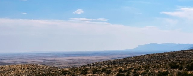
Some 262 million years ago everything you see out of the car window was under water. There was a large inland sea that covered this part of New Mexico and into much of west Texas.  Tiny organisms, sponges, and algae lived in that warm sea (we were close to the equator back then) and they (somehow) came to the decision to build a reef. They did that for a few million years, building up a huge reef by any standards, hundreds of feet thick. By and by climates and earth forms changed and the inland sea’s only little outlet to the wider global ocean was blocked. It dried out. Another sea came back some millions of years later and deposited sediment on top of the reef and the old seabed. That sea left, too. Millions of years pass and there was an uplifting and various contortions of the earth surface. The reef was re-exposed and acidic groundwater began to percolate down through the now-consolidated limestone of the old reef. Air pockets formed and enlarged and then greatly enlarged until, voilà, the Carlsbad Cavern cave system was born. It has existed for over 500,000 years adding, and probably destroying, various cave features and formations as time passed. The dinosaurs were here more or less from 200 million years to 66 million years ago when the big mass extinction took place. Some small mammals survived as did some flying dinosaurs.  The bats arrived at Carlsbad sometime later.

Speaking of bats. most of the people I spoke with were hugely impressed with the evening bat flight out of the cave entrance during the warm months. About a million of bats all exit the cave at the same time. I spent ten years exploring caves, large and small, back when I was an immortal being, about age eleven to twenty. There was no hole too small for me to wriggle into and I often wonder now how I survived. About every fifth “wild” cave is named “Bat Cave” and there is good reason for that — they are often full of bats. They pretty much ignore cave explorers but since we sometime occupy the same space — you get to see your fill of bats. I was never touched by one — they are amazing creatures. They eat tons of bugs each night. I have an old blooming Agave plant in my yard that is pollinized by bats at night. I just didn’t want to see a million of them. Maybe next time.

Bats live only in the upper portions of the cave near the natural entrance. You do actually see a lot of bat evidence as you enter the cave through the natural entrance. The creatures you see flying around the cave entrance are birds, so you get to see bird evidence, too.
IMG_0772

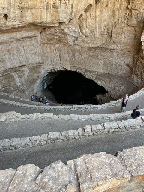
The natural entrance (as opposed to the elevator entrance) is a challenge. There are lots of switchbacks — God knows how many — as you descend into the cave. I think my knees might know how many switchbacks there were. You actually descend about 800 feet below the surface on the self-guided tour. The ranger-guided tour might go a bit deeper than that. You slowly lose sight of any daylight, and the walkway is damp and a little slippery.  Some people are helpful with flashlights or iPhone lights, but your eyes really need to adjust to the darkness as the park service has not provided much light to help you on your way. Do not attempt this natural entrance unless you are fully fit and steady on your feet. (Read that sentence again.) I am nearly 75 and a bit overweight with a fake hip and bad knees and I made it. There were people who were not managing it very well. I suspect there are some medical emergencies or rescues on occasion.
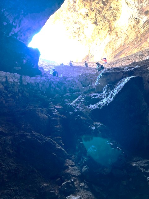
IMG_0773 (1)x

You will do a lot of walking. My step counter said five miles going in, touring, and then coming out on the elevator. There was no way I was going to climb back out the way we came in. It is over a mile from the beginning of the natural entrance to the actual cave rooms that you are there for, mostly in near darkness. There are handrails along the paved walkway most of the way.  But the hike in was an experience and I’m glad to have done it. It reminded me of my youth.

The cave is enormous and still being explored. They are still finding passages and rooms farther and deeper into the cave. The website for the park includes a map showing the routes and rooms in the cave that can be visited. You can’t really gauge the enormity of the largest room, aptly named “The Big Room”, and can’t always realize how high the ceiling is above your head. You can see on the map the “Iceberg Rock” which fell from the ceiling some 500,000 years ago. In reality, you can’t actually imagine something that large crashing down, so you look around at smaller things thinking that is what they mean — but you are walking on top of the gigantic rock for some distance. 
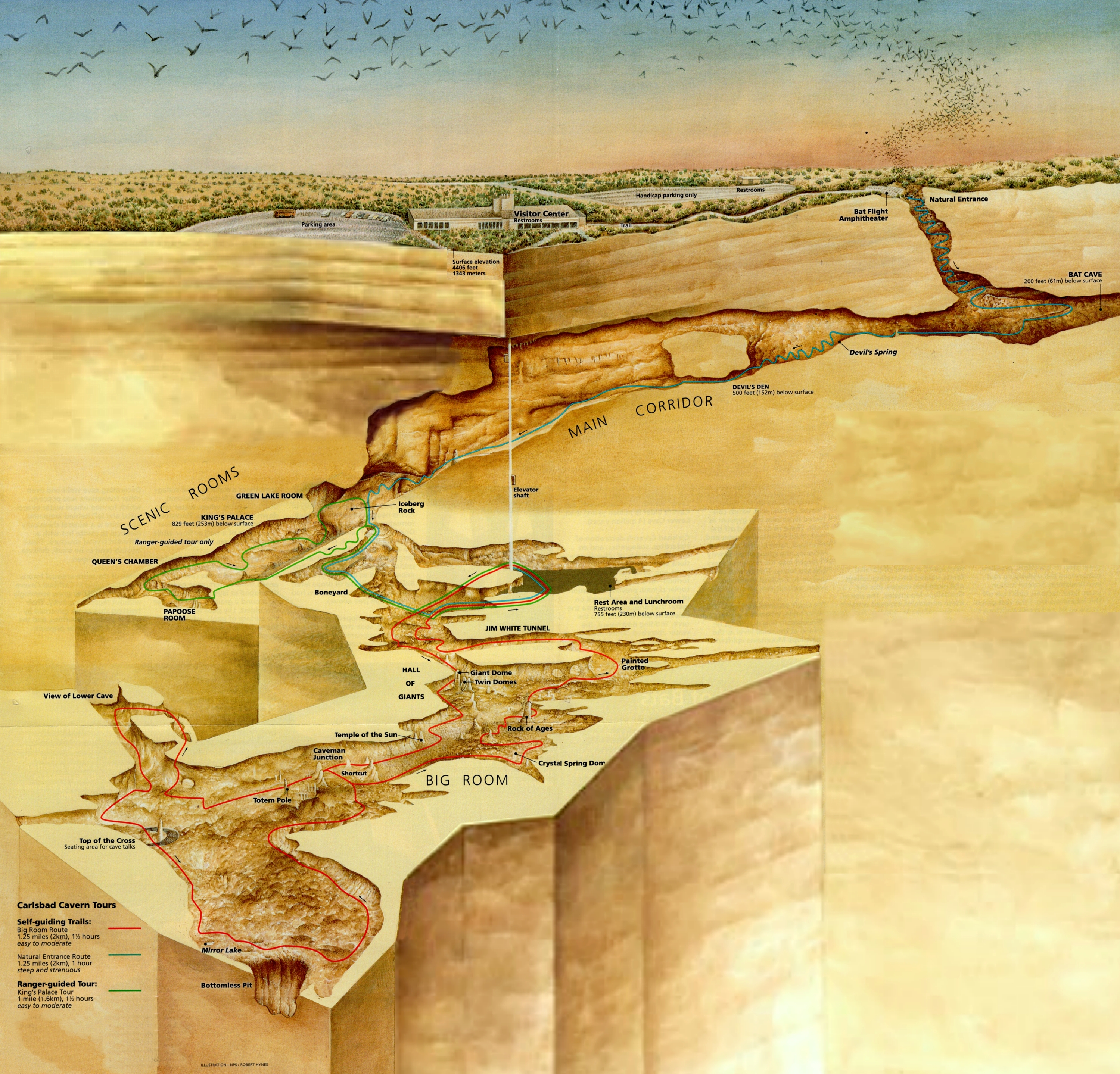
Carlsbad map

National Park Service

As you can see, you have a lot of a cave to cover. No strollers so you need to carry that sleepy toddler. Some parents had kid carriers like backpacks. The kids we saw were well behaved and none of them were having a bad day.

Photography Issues

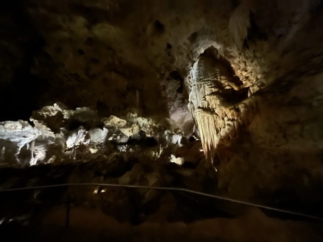
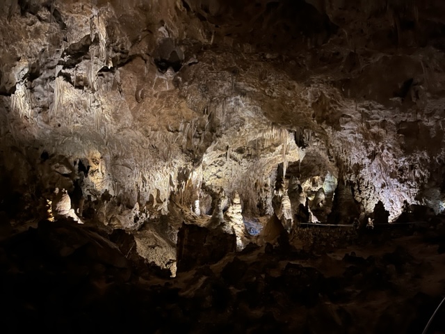
Photography in the cave turned out to be a challenge. I took my usual Nikon camera (Coolpix B600) and probably should have studied up or reviewed the settings, but I couldn’t predict the conditions. If I had all the time in the world, it would have gone better. This is not a typical photo situation. The contrast is so stark between the pitch black (or nearly so) and the spotlighted featured cave formation that the camera was not able to focus and manage the lighting as I was used to. I was disappointed in many of the photos I took with the camera. It worked well under lighted scenes, but I could not hold it still long enough keep the image from blurring in some extreme cases. Conditions allow you to take multiple photos but not fully manage the settings. The walkway was busy but not crowded. I kept about half of the images. I was able to work with some to improve the contrast or shadows.
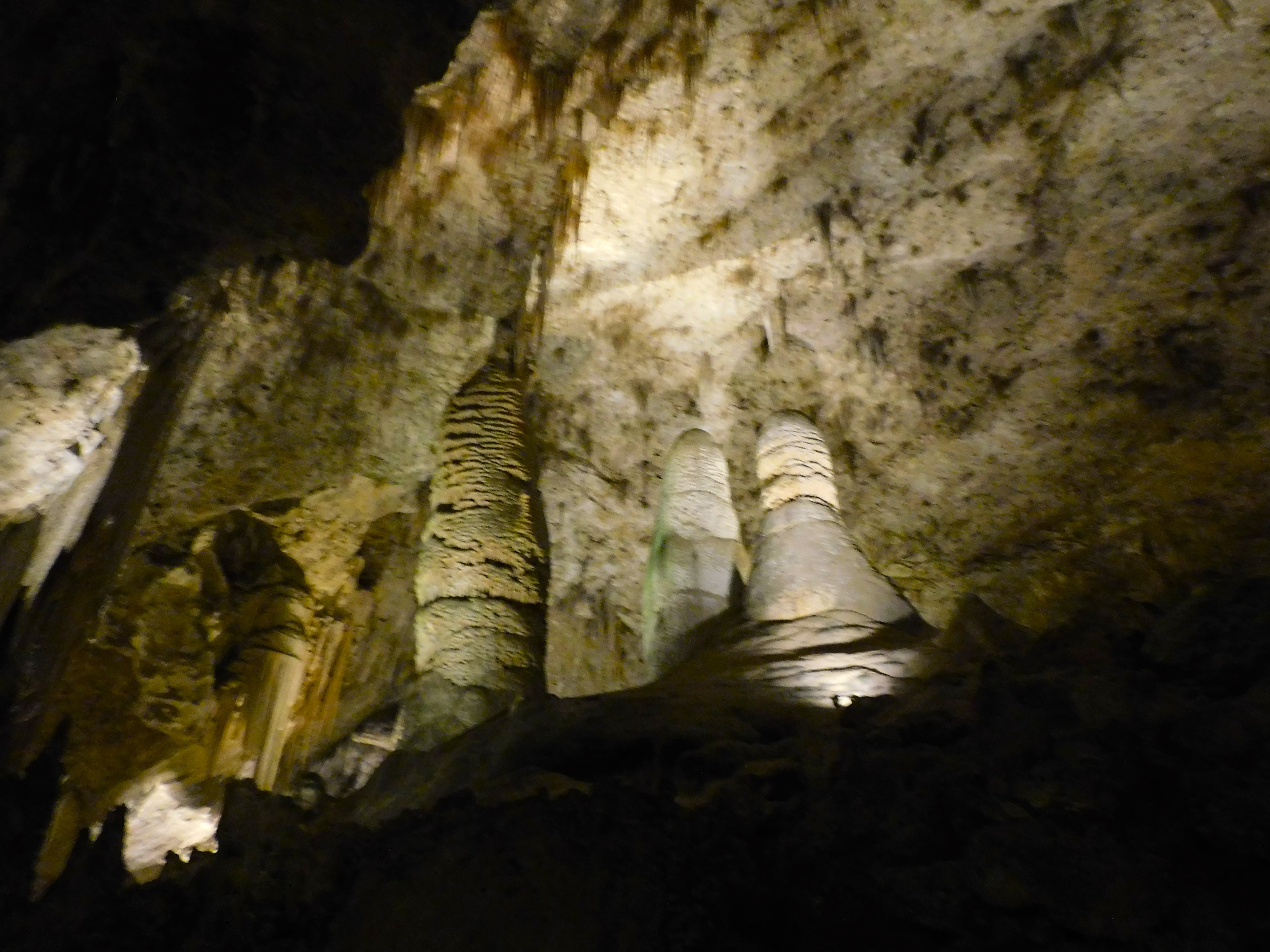
DSCN6630x

On the other hand, my iPhone camera was able to handle the conditions quite well. I was impressed with the quality. The contrast worked nicely and there was not a problem with blurring from movement.
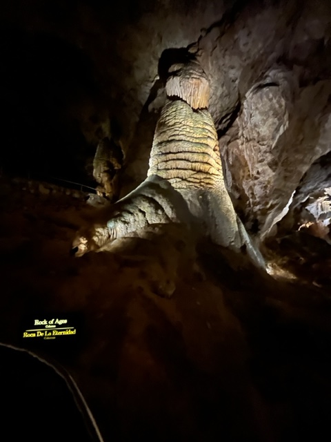
IMG_0801

IMG_0803

IMG_0784

And, of course, a big thank you for such a nice Fathers’ Day trip from a wonderful daughter. 

Good to know tip…

When you decide to go to Carlsbad Caverns, you should go online and buy a timed ticket. That will give you a one-hour span of time to enter the cave. Once in, you can stay to tour the whole thing – the ticket helps manage the entries. You also have to pay an admission to the park unless you are in possession of a National Park Pass — like me.  When you enter the visitor’s center you are immediately confused by the enormous, and slow, line of people stretching back over 100 feet or more waiting in line to pay admission and get their ticket. If you have a park pass and already bought your ticket and have it with you (on your phone or printed), head over to the information desk to see if you need to get in the line. We were able to go through without waiting in line for an hour. But there is no one there to tell you or a sign that directs you around the line.
IMG_0776 (1)

  *     *     *  


Valles Caldera Backcountry

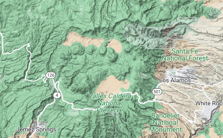
The Valles Caldera National Preserve is located 92 miles north of downtown Albuquerque in the Jemez Mountains, north of Jemez Springs. I recently had the opportunity to explore the backcountry with my camera. That part of the preserve has restricted access to preserve its pristine environment. Access is by a special scheduled permit and only a few cars are allowed into the area each day. The Caldera is a unique feature in the Jemez Mountains; a place already unique as a “sky island” of green surrounded by desert. 

The Caldera is the site of a huge collapsed volcano. The volcano erupted and subsequently collapsed into the emptying magma chamber. It apparently did this three times over the many millions of years. The last major eruption was 1.25 million years ago, but volcanic activity continues. Lava domes developed followed the eruption and collapse and continued as recently as 40,000 years ago. Geothermal features persist today. You can smell the sulfur at times. 


I have been to the caldera many times but never ventured into the far backcountry. I went snowshoeing up there this past winter. We were watching elk and coyotes last fall in Valle Grande.

valles caldera map

Google Maps

Valle Grande is the large valley adjacent to Highway 4. In the backcountry there are several prominent lava domes and three valleys — from west to east: Valle San Antonio, Valle Santa Rosa, and Valle Toledo. San Antonio Creek and tributaries run through these valleys and exit the caldera, joining up with the Jemez River at Battleship Rock, north of Jemez Springs.

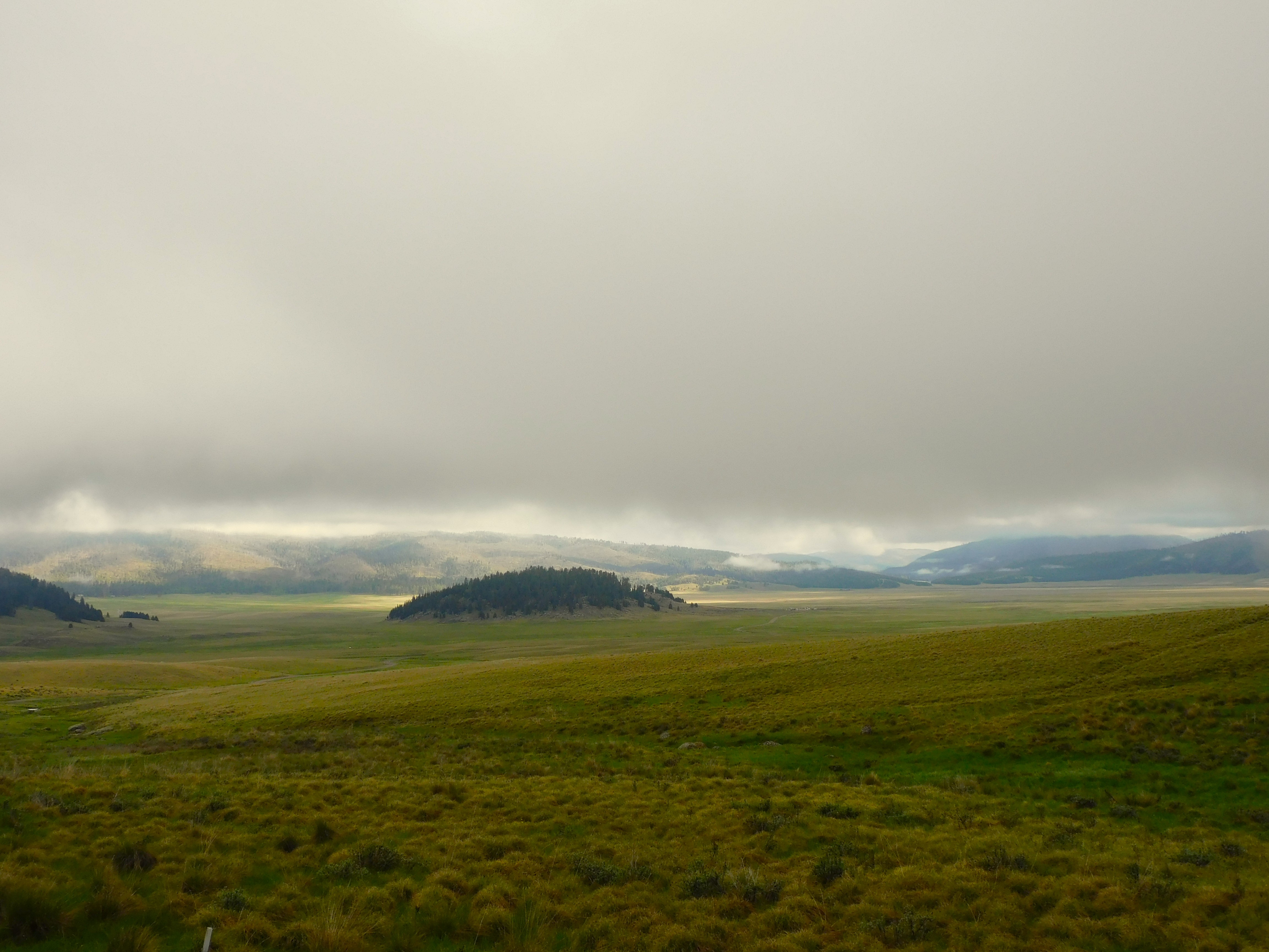
It was a bit foggy and with low clouds on the morning of our visit. Valle Grande is impressive any time but particularly so in these conditions. The temperature was in the 40s early in June.

DSCN6424x

The permit into the backcountry includes a code to open the locked gate. It only works on one of the three locks. Your quest is to guess which one is the right one — or so it seemed. We finally figured it out. The sky was clearing, and the sunlight and cloud shadows drifted across the caldera.

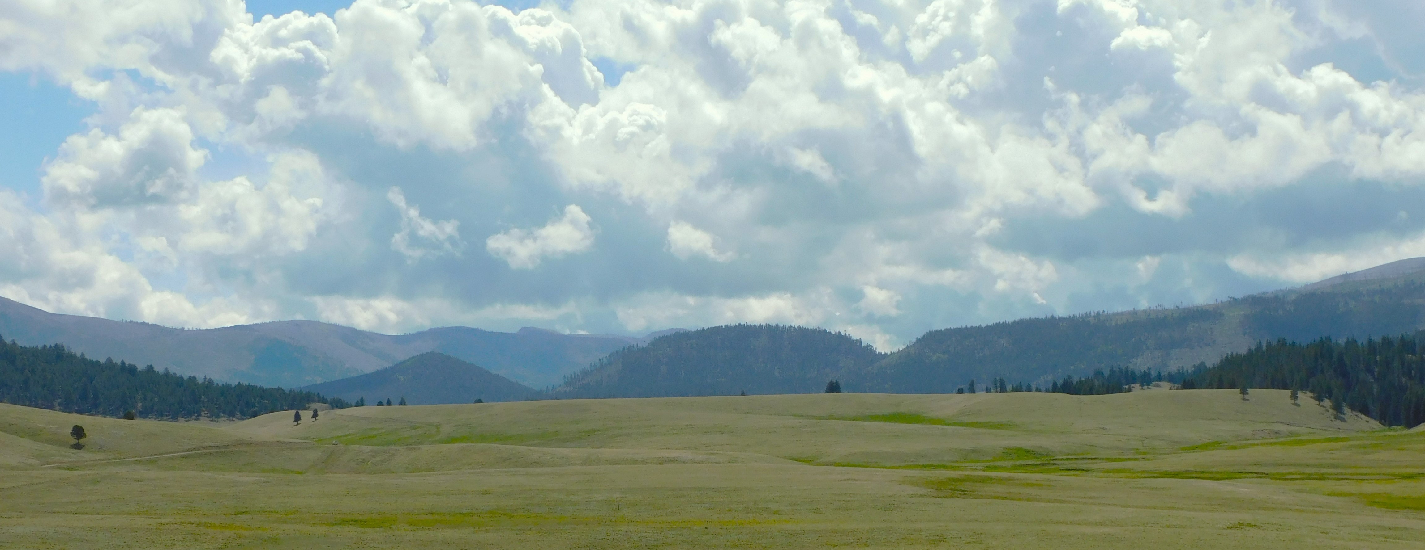
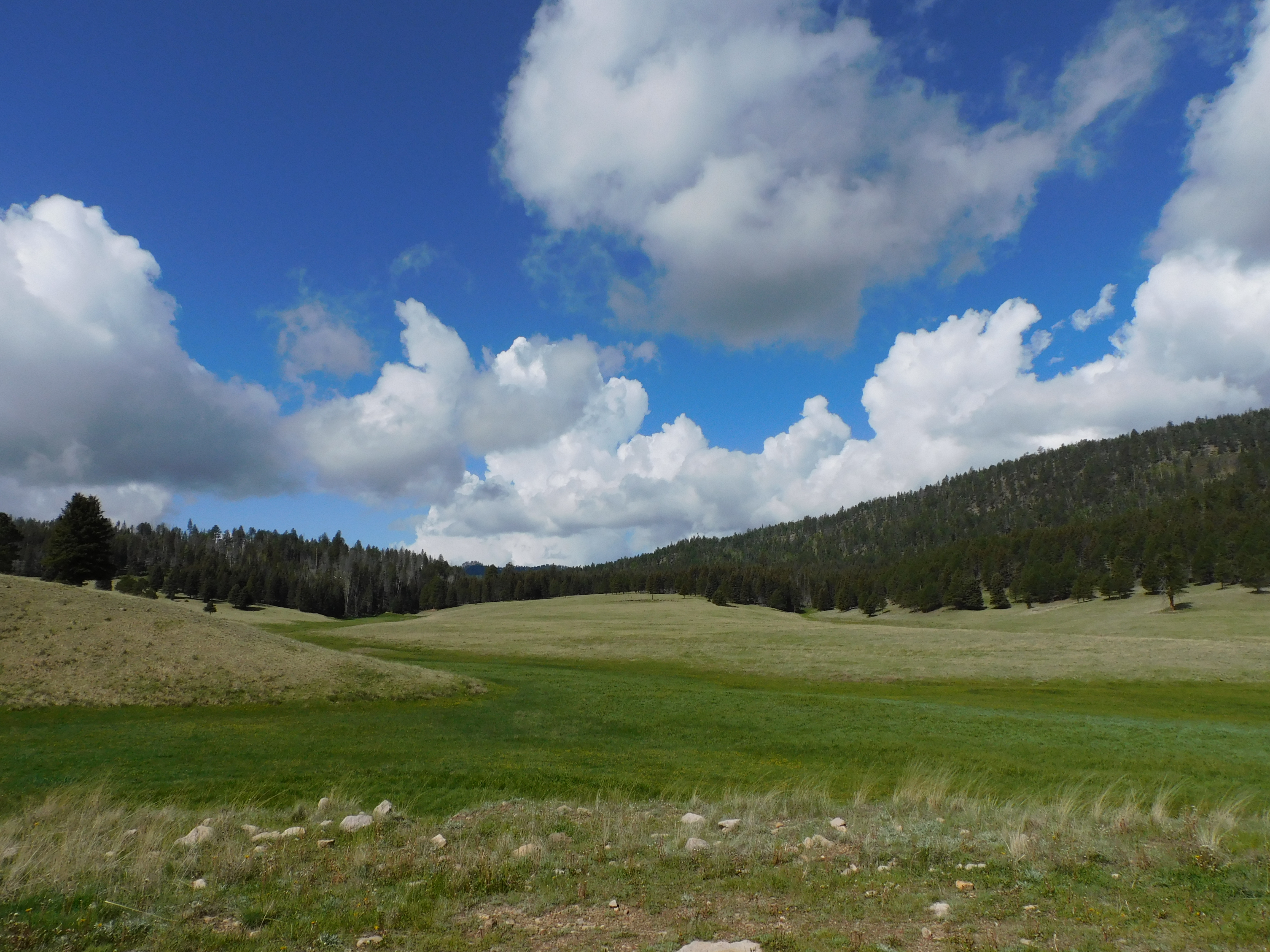
The multiple lava domes are apparent at various places in the three valleys. There are also ancient lake deposits since the caldera was once filled with water.

DSCN6494xy

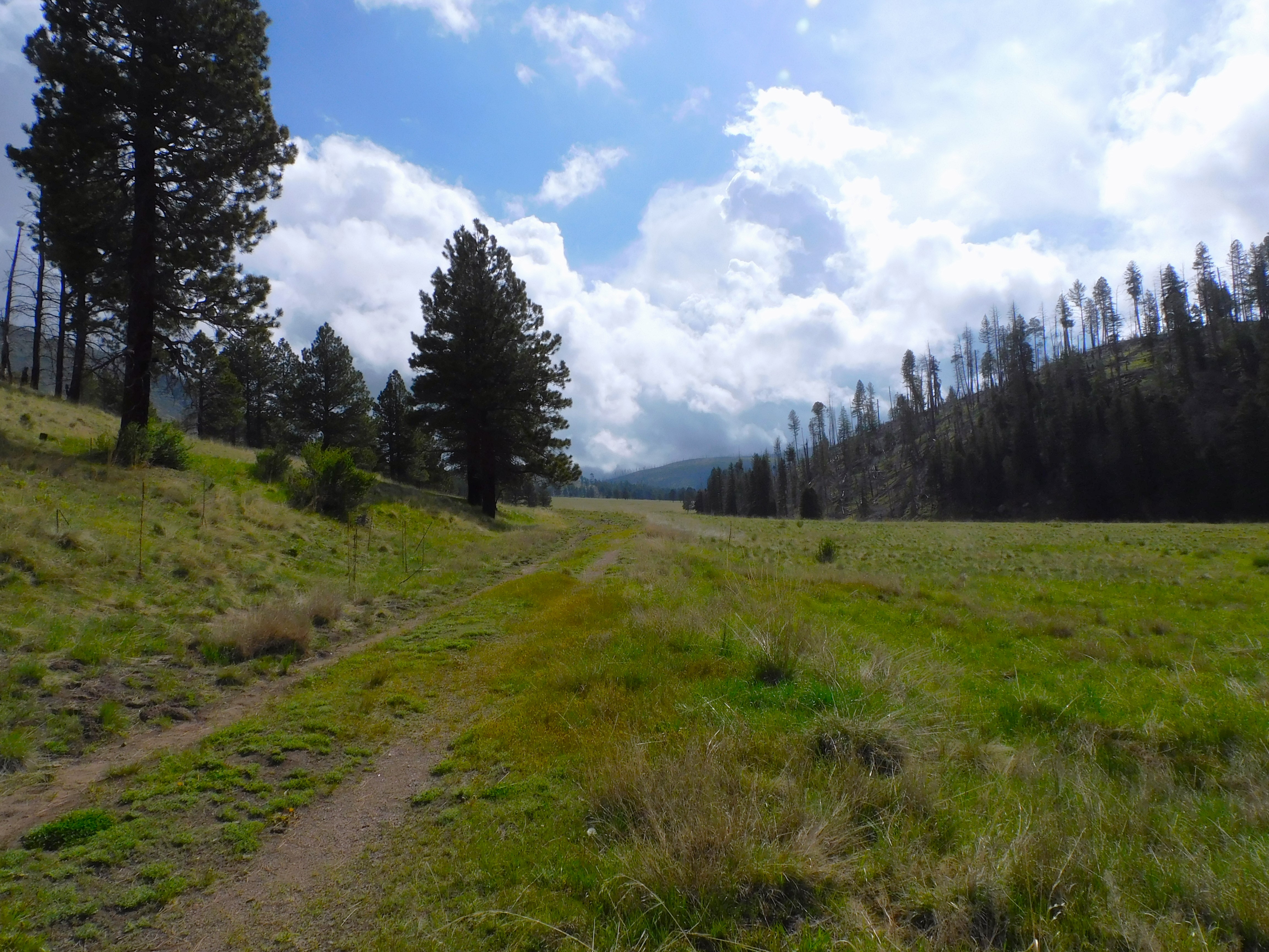
It takes close to an hour to drive back into the far valleys but the scenery is gorgeous all the way. The place was once a working ranch and there are a few remnant vestiges of the ranching days.

There are still a few cattle grazing among the buttercups as in the old days. This was once the 95,000-acre Baca Ranch. I think it must have been cowboy heaven — except maybe in the snowy winters. The snow was over 100 inches in places this past year. 

There are elk here in the thousands. I saw an estimate of the elk to human ratio of 5000 to 1 — but that is surely a exaggeration, right?  I have seen elk here but not on this trip and they stay concealed except in the rutting season. This must be elk heaven, too.

DSCN6449

Access to the Valles Caldera is controlled. There is no camping. Everyone must be out of the preserve by 6 PM. That means that one’s time in the backcountry is limited. You have to head out before 5 to reach the front gate by 6.  I could tell you how to get access to the backcountry — but I can’t. I’d then be tempted to kill you — so I’ll let you research it. There is a small cost for the access permit and there is another cost for a fishing permit.

DSCN6445x

One reason for access to the three valleys is the fishing. It is good fishing for trout on the Rio San Antonio. The river is small but pristine and you mostly have it to yourself. Some fishermen would give their right arm to fish in that kind of water– but then they probably couldn’t fish it at all.

DSCN6511

DSCN6509

DSCN6515

It is achingly beautiful.  I will stop here, with a few more pictures, because I simply want to blab on and on about the place. They say a picture is worth a thousand words so I will simply express myself that way. 

IMG_0683

                       *     *     *     

Casa San Ysidro – Heritage Day

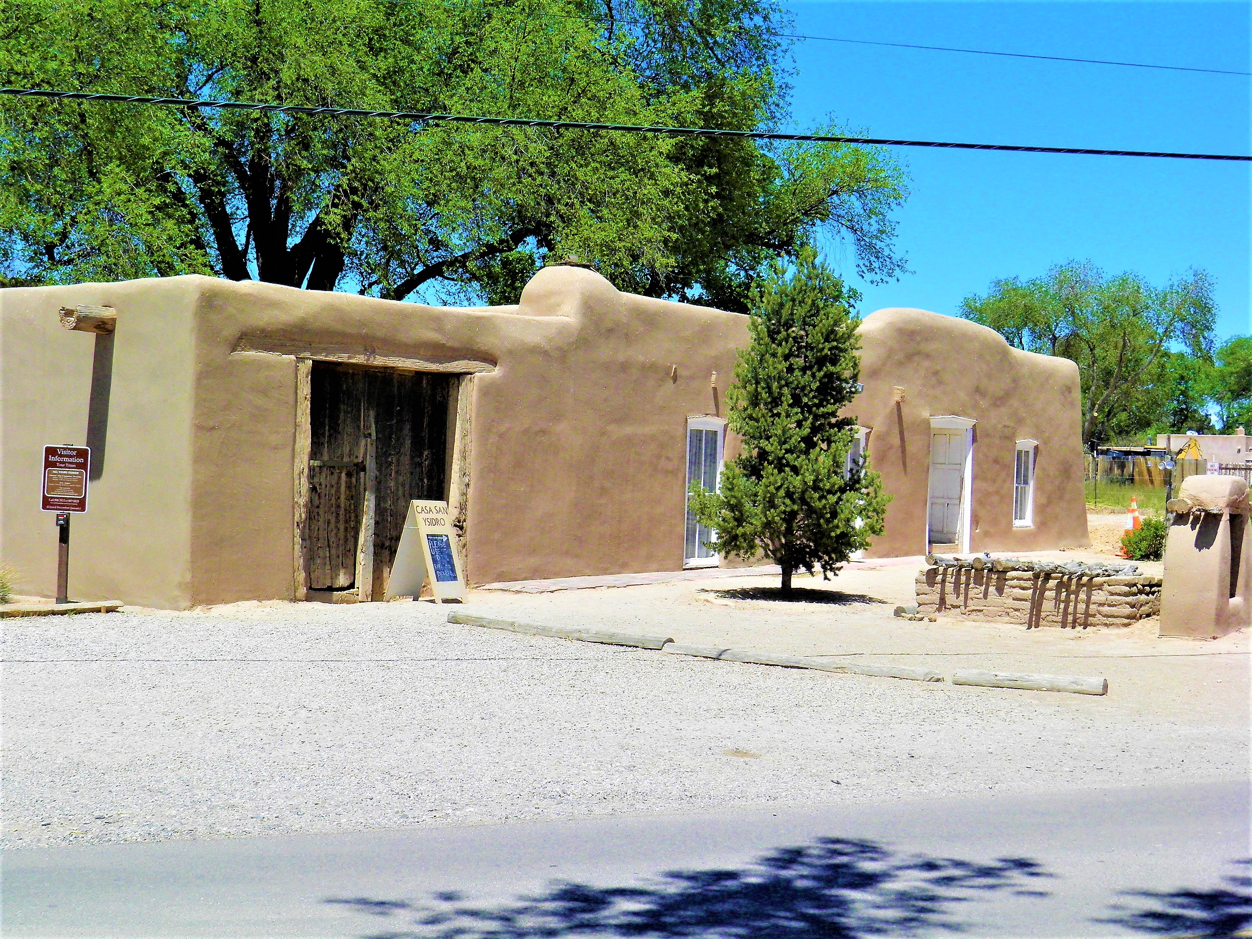
May 13, 2023 was Heritage Day at Casa San Ysidro in Corrales. The 1870 ranchito Casa is part of the Albuquerque Museum and serves as a showplace for life and material culture of New Mexico in the late 1800s. Some of the artifacts on exhibit go back much earlier. For example, there is a loom that dates to the 1770s.The museum staff hold Heritage Day every year and this year the town participated with exhibits and events scattered through the village.

(Photo from an earlier visit)

Probably the best way to describe the Casa San Ysidro is to quote the National Park Service description:

Casa San Ysidro is a historic house museum that features a renovated Territorial Period Greek Revival house built around 1875 by the Gutiérrez family and a speculative recreation of a 19th century rancho constructed by the Dr. Ward Alan and Shirley Jolly Minge. The Minge collection exhibits salvaged architecture, furniture, religious art, tools, Hispanic and Pueblo weavings and pottery from the 17th, 18th, and 19th centuries.

The “speculated” part is a pretty well true to form recreation of a Territorial Period rural farmstead located along the old El Camino Real de Tierra Adentro connecting Mexico City to Santa Fe. The Minges were experienced and successful collectors and were very well connected and known in communities and pueblos of northern New Mexico.

The ranchito was a working farm residence, not as large or commercial as what we might consider a hacienda. It would have had some attention given to safety and security with the residential and working space enclosed within high walls. Casa San Ysidro is partially a modern (1940s) construction added to an old 1870s original farm residence.  The last private owners, the Minges family, acquired the property from the original Gutiérrez family.

DSCN6251x

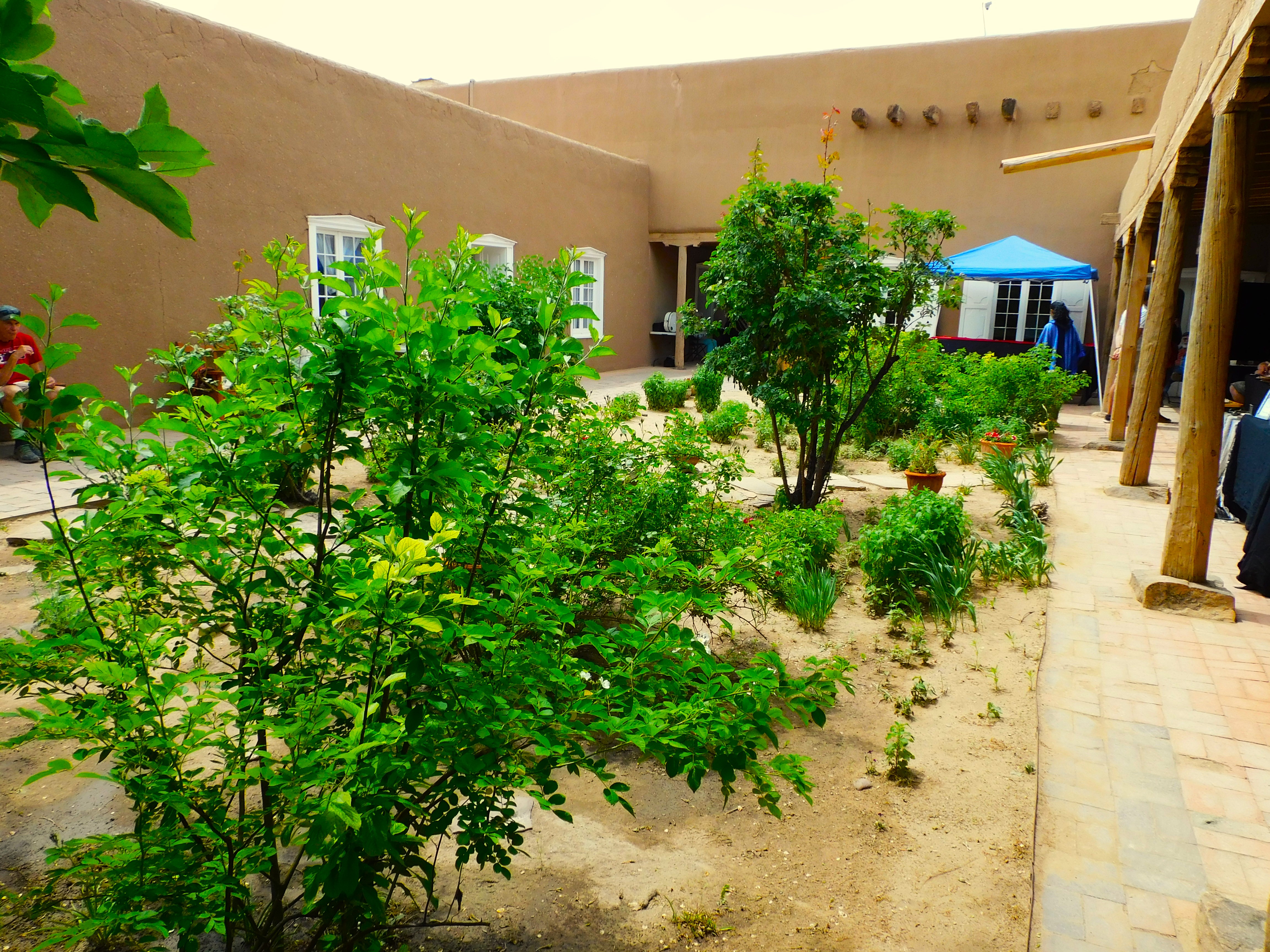
Plazuela gardenHeritage Day is an annual free admission day that includes docents and craft people included weavers, a blacksmith, several artisans, and music from a classical Spanish guitar musician.

We arrived a little late but there were a few dozen visitors. Maybe 300 for the day, A free event is usually held on the second Saturday of each month.

                                                     *     *     *