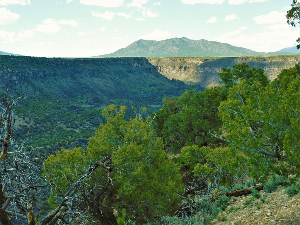
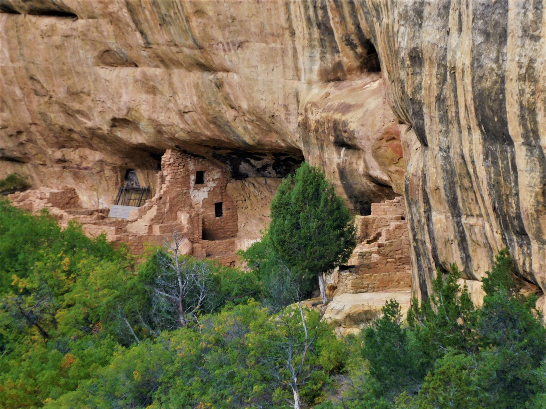
Wanna Get Away?

IMG_0827I have a couple comrades who like to get away into the New Mexico outback — like me — and we have been roaming through the Rio Puerco/Cabezon Peak area, went to a mining ghost town, a few other places in the Jemez Mountains, and in the east mountains. We did this recently before the heat made us suspend our adventures. One is a trained geologist — the  paleo kind. He is a profesional photographer with his own business. The other is an avid rock hound and scrounger of any interesting debris. He finds some amazing stuff. I’m a photographer and poet and like to ramble. I have an interest in history and some geology training.  Here are a few pictures of what we have been up to these past few months. I enjoy going solo a lot of times but at my age it is good to have someone along.

Golden Open Space Area — East Mountains

The east mountains are east of Albuquerque. They have names — the San Pedro’s, the Ortiz, the Cerillos Hills, and South Mountain, – a volcano.  There is gold in them thar hills and some working gold mines. The Ortiz Mountains had the first gold strike way back in the 1820s or so, while under Mexican control. There are many mines in the area, not just for gold. The town of Madrid was a coal mining town. The Cerillos Hills is where the Pueblo Indians mined turquoise for trade all the way to Yucatan.  The Golden Open Space area is a public area owned by the city of Albuquerque but quite distant.  There were no other visitors that day and the temperature was in the 90s. You can click on the photos for a larger view.

It was too hot to poke around as much as one would like. There are a few fossil seashell imprints, but it would seem that there would be more than that but didn’t get across the deep arroyo that day.

The Kelly Mine and Ghost Town

The mining district near Magdelena. New Mexico produced zinc ore and maybe six or more other profitable minerals including some silver and gold. The Kelly Mine operated from about 1880 into the 1920s, more or less, and mostly produced zinc ore. It is private but open for public access and still has some impressive mine structures, tailing piles, a few shafts, and a few standing walls and a cemetery from the old town. This is rock-hound heaven. We made the journey and spent most of a day roaming around the site. There were a few other visitors that joined us later in the day, but the site is mostly empty. The road leading to the place is a challenge. We found some interesting mineral specimen rocks including some “Fool’s Gold” and some zinc and quart.

We had the benefit of a drone so we could look around the hillsides and over the ridge to see what was accessible. The head frame was a nesting site for a family of crows who were not happy to see us or the drone.

Magdelena is a few miles down the road. There is not much there for visitors. There are other mines and ghost towns located to the north of town. That will be a future trip.

The Volcanoes — Petroglyph National Monument

Just immediately west of Albuquerque, on the west mesa, are several notable small volcanoes. Once upon a time, a five-mile crack opened and lava flowed out covering the mesa top. The crack became clogged in places and several smallish volcanoes erupted where the magma was still able to get through. The hard lava basalt covers the top of the mesa, but the volcanoes are a notable feature on the western horizon. It is a good place to hike and take photographs on a good day. The city and river valley are laid out below and the Sandia Mountains are directly across, holding up the east side of the Rio Grande Rift.

On our visit the Prickly Pear Cactus were in full bloom along with other wildflowers and a ringneck lizard joined the party by posing on a rock for a while.

In the ten years I have visited the volcanoes the Park Service has been gradually restricting access to certain areas. Visitors can still climb the middle volcano but not the other two. The area was a bit over used and is a fragile and easily damaged desert environment. The volcanoes also hold some sacred value to the local Pueblo Indians.

Shark Tooth Ridge

Shark Tooth Ridge is an ill-defined area noted for the presence of fossilized shark’s teeth out near the Puerco River and Cabezon Peak area. This is definitely the outback, and you can get lost out there if you try hard enough. It is not very easy to find and an hour or more west of Albuquerque.

This is part of the Mount Taylor Volcanic Field and there are dozens of old volcanoes and volcanic plugs. Cabezon Peak is the most prominent one and resembles Devil’s Tower in Wyoming but is a little larger. The last 15 miles are dirt roads and there are many to choose from — that is the challenge.  We found the place on our first try. Finding our way out was a little trickier.

We searched for several hours but never found a shark’s tooth, but the geology is interesting and so is the scenery. It is curious being both volcanic and also seabed sedimentary mixed together.  Since our visit one of our team did find a couple shark’s teeth so they are out there. We will go back. There are a lot of photo ops and a number of wild horses that roam the area.  There are also a few homestead relics where someone tried to settle in the area.

DSCN6053x

One thing I’ve noticed in the places we have been visiting is the lack of vandalism and “tagging” that you often see out in public spaces. That was especially true at the Kelly Mine where you might expect to see some vandalism.  Other places that we have visited, most notably the Gilman Tunnels, there is a lot of graffiti scrawled on certain areas. I guess people carry spray paint cans simply for the act of defacing public areas. I don’t get it.

Other places we have been visiting include the Gilman Tunnels and the Valles Caldera, both up in the Jemez Mountains, and the Hoodoos in the Ojito Wilderness. I have posted descriptions of those last three already.

     *     *     *

Carlsbad Caverns Trip

My daughter took me to Carlsbad Caverns for Fathers’ Day. I finally got to go — and I feel like I’m almost the last person who hasn’t seen it based on stories from friends. It is a wonder of wonders, just like they all said. Bear with me — it does involve photography.

Getting there has been the challenge for me over the ten years that I have lived in New Mexico. Even though it is in the same state, it is a 750-mile round trip journey from Rio Rancho to Carlsbad and it is not the most scenic route. A month ago, we had occasion to spend a weekend in Roswell, another new place for me, and it was a reasonable and enjoyable trip. We had a nice stay — so we figured that we could stay in Roswell again and make a day trip to Carlsbad – there and back. From here you go east on I-40 to Clines Corners. That is the roadside emporium where you can find almost any sort of tourist paraphernalia you want. Rubber tomahawk? You got it. Hat or Cowboy boots? Yep, pardner, right over there. A full cowhide? Sure, why not? Popcorn, peanuts, candy-coated snacks? You bet. Bathroom? Yessiree. The scenery was typical interstate up to that point. From there it was straight down highway 285 onto the high plains – let me emphasize straight. It is a better road than the interstate because nobody is on it. Dual highway straight to Roswell and then on south to Carlsbad.

People complain about the high plains as they drive the interstate. Off of the interstate it reveals a different character and timelessness. I like driving backroads through Kansas and this was similar but no corn or soybeans — just grass and cactus as far as the eye can see. off in the distance there might be a wind farm, then a windmill and a water tank surrounded by cattle. Then a lonely single-file parade of cattle going nowhere in a hurry — for what? You can see twenty miles ahead and behind and there isn’t anything to get you moving. There are occasional trees that offer shade for a half-dozen cows. The Antelope, that you occasionally see as well as the cattle, must browse the tree leaves and branches and open up space for the cattle. Mighty considerate.

You will pass through Encino after a while. You see it ahead because of the trees. It is mostly dead or dying as a town. Halfway to Roswell is Vaughn. You might have noticed the freight trains over on the left (east) at some distance. The railroad has a presence in Vaughn. I think it would be a ghost town otherwise.  You will be hungry and wanting to get out and stretch by the time you get to Vaughn, especially if you didn’t go into Cline’s Corners. Vaughn has Penny’s Diner — a retro shiny metal-sided recreation of the old diners of bygone days. It is part of the Travelodge that sits back behind it and part of a chain of diners associated with that motel. I had a classic BLT that was great. The manager/waitress/motel clerk/server/cashier was doing temporary duty in Vaughn in that capacity — shipped there by Travelodge for two weeks from Yuma, Arizona because there was nobody local in Vaughn who would or could do the job.  Somebody had to mind the store — the railroad crews seem to be local customers and were not going away. The freight line was pretty busy.

After our sojourn in Vaughn, we continued across the plains to Roswell. I think I talked about Roswell before. It hasn’t changed in the last month. We ate at a nice Mexican restaurant. The primary entertainment back at our hotel was the US-Mexico soccer game — a shitshow that was eventually ended a few minutes early due to Mexico vans’ bad behavior — shouting homophobic slurs and throwing stuff on the field. The US team won 3-0.

The road to Carlsbad is much the same except for oil wells instead of wind turbines. I wonder why? Artesia still smalls bad due, I guess, to the petrochemical plant. Oil and gas seems to be their bread and butter here in Artesia. The state’s largest refinery is here. As a curiosity, check out Artesia’s old  Abo Elementary School in Wikipedia.

Moving right along, Carlsbad and the caverns are about another hour or so ahead. Carlsbad has a fresh coat of paint, new buildings and businesses, and is looking pretty good. The money and investment is coming from somewhere — maybe more of that oil and gas money?  It’s a town of about 32,000 residents and the Carlsbadians are doing pretty well from the looks of it. At Carlsbad you take a right onto highway 62. The caverns are actually located at White’s City, another ten miles along highway 62, you can’t miss it. (Mr. White was an early cave explorer who was responsible for getting things going.) Entering the national park, you drive another five miles or so through a winding canyon and climb out at the top of the hill to arrive at the main park visitor center.

Time for a little geology.

IMG_0810x

Some 262 million years ago everything you see out of the car window was under water. There was a large inland sea that covered this part of New Mexico and into much of west Texas.  Tiny organisms, sponges, and algae lived in that warm sea (we were close to the equator back then) and they (somehow) came to the decision to build a reef. They did that for a few million years, building up a huge reef by any standards, hundreds of feet thick. By and by climates and earth forms changed and the inland sea’s only little outlet to the wider global ocean was blocked. It dried out. Another sea came back some millions of years later and deposited sediment on top of the reef and the old seabed. That sea left, too. Millions of years pass and there was an uplifting and various contortions of the earth surface. The reef was re-exposed and acidic groundwater began to percolate down through the now-consolidated limestone of the old reef. Air pockets formed and enlarged and then greatly enlarged until, voilà, the Carlsbad Cavern cave system was born. It has existed for over 500,000 years adding, and probably destroying, various cave features and formations as time passed. The dinosaurs were here more or less from 200 million years to 66 million years ago when the big mass extinction took place. Some small mammals survived as did some flying dinosaurs.  The bats arrived at Carlsbad sometime later.

Speaking of bats. most of the people I spoke with were hugely impressed with the evening bat flight out of the cave entrance during the warm months. About a million of bats all exit the cave at the same time. I spent ten years exploring caves, large and small, back when I was an immortal being, about age eleven to twenty. There was no hole too small for me to wriggle into and I often wonder now how I survived. About every fifth “wild” cave is named “Bat Cave” and there is good reason for that — they are often full of bats. They pretty much ignore cave explorers but since we sometime occupy the same space — you get to see your fill of bats. I was never touched by one — they are amazing creatures. They eat tons of bugs each night. I have an old blooming Agave plant in my yard that is pollinized by bats at night. I just didn’t want to see a million of them. Maybe next time.

Bats live only in the upper portions of the cave near the natural entrance. You do actually see a lot of bat evidence as you enter the cave through the natural entrance. The creatures you see flying around the cave entrance are birds, so you get to see bird evidence, too.

IMG_0772

The natural entrance (as opposed to the elevator entrance) is a challenge. There are lots of switchbacks — God knows how many — as you descend into the cave. I think my knees might know how many switchbacks there were. You actually descend about 800 feet below the surface on the self-guided tour. The ranger-guided tour might go a bit deeper than that. You slowly lose sight of any daylight, and the walkway is damp and a little slippery.  Some people are helpful with flashlights or iPhone lights, but your eyes really need to adjust to the darkness as the park service has not provided much light to help you on your way. Do not attempt this natural entrance unless you are fully fit and steady on your feet. (Read that sentence again.) I am nearly 75 and a bit overweight with a fake hip and bad knees and I made it. There were people who were not managing it very well. I suspect there are some medical emergencies or rescues on occasion.

IMG_0773 (1)x

You will do a lot of walking. My step counter said five miles going in, touring, and then coming out on the elevator. There was no way I was going to climb back out the way we came in. It is over a mile from the beginning of the natural entrance to the actual cave rooms that you are there for, mostly in near darkness. There are handrails along the paved walkway most of the way.  But the hike in was an experience and I’m glad to have done it. It reminded me of my youth.

The cave is enormous and still being explored. They are still finding passages and rooms farther and deeper into the cave. The website for the park includes a map showing the routes and rooms in the cave that can be visited. You can’t really gauge the enormity of the largest room, aptly named “The Big Room”, and can’t always realize how high the ceiling is above your head. You can see on the map the “Iceberg Rock” which fell from the ceiling some 500,000 years ago. In reality, you can’t actually imagine something that large crashing down, so you look around at smaller things thinking that is what they mean — but you are walking on top of the gigantic rock for some distance. 

Carlsbad map

National Park Service

As you can see, you have a lot of a cave to cover. No strollers so you need to carry that sleepy toddler. Some parents had kid carriers like backpacks. The kids we saw were well behaved and none of them were having a bad day.

Photography Issues

Photography in the cave turned out to be a challenge. I took my usual Nikon camera (Coolpix B600) and probably should have studied up or reviewed the settings, but I couldn’t predict the conditions. If I had all the time in the world, it would have gone better. This is not a typical photo situation. The contrast is so stark between the pitch black (or nearly so) and the spotlighted featured cave formation that the camera was not able to focus and manage the lighting as I was used to. I was disappointed in many of the photos I took with the camera. It worked well under lighted scenes, but I could not hold it still long enough keep the image from blurring in some extreme cases. Conditions allow you to take multiple photos but not fully manage the settings. The walkway was busy but not crowded. I kept about half of the images. I was able to work with some to improve the contrast or shadows.

DSCN6630x

On the other hand, my iPhone camera was able to handle the conditions quite well. I was impressed with the quality. The contrast worked nicely and there was not a problem with blurring from movement.

IMG_0801

IMG_0803

IMG_0784

And, of course, a big thank you for such a nice Fathers’ Day trip from a wonderful daughter. 

Good to know tip…

When you decide to go to Carlsbad Caverns, you should go online and buy a timed ticket. That will give you a one-hour span of time to enter the cave. Once in, you can stay to tour the whole thing – the ticket helps manage the entries. You also have to pay an admission to the park unless you are in possession of a National Park Pass — like me.  When you enter the visitor’s center you are immediately confused by the enormous, and slow, line of people stretching back over 100 feet or more waiting in line to pay admission and get their ticket. If you have a park pass and already bought your ticket and have it with you (on your phone or printed), head over to the information desk to see if you need to get in the line. We were able to go through without waiting in line for an hour. But there is no one there to tell you or a sign that directs you around the line.

IMG_0776 (1)

  *     *     *  


America, in Black and White

DSCN4614ab

Oklahoma

America seems more and more to be slipping out of its once vibrant palette into a black and white existence. There seems to be very few gray areas left and not much color. We have somehow lost our ability to see where one thing fades into another. The nuances of opinion or the appreciation of compromise is lost. The “all or nothing” perspective seems to be winning out as long as “we” get all and “you” get nothing.  I have my own opinions and observations, which I sometimes share on another blog.

This thought occurred to me on my spring road trip cross-country back to my old hometown of St. Louis for a family wedding. That’s about 2,500 miles, roundtrip, and half of it was with my adult daughter who arrived in St. Louis by a long and round-about train trip and accompanied me on the homeward leg of the trip. I traveled through New Mexico, Oklahoma, Kansas, and Missouri and we also passed through the Texas Panhandle on our way home. That is a lot of pavement and time to think and talk. Her Amtrak trip took her through Arizona, California, Oregon, Washington, Idaho, Montana, North Dakota, Minnesota, Wisconsin, and Illinois. Together, we covered fifteen states and talked to people along the way. One thing that sometimes happens in casual conversation is that the other person assumes you are of the same mind as they are on some topics. Perhaps they do not recognize that there can be a different and valid opinion. Some of those conversations included a pair of neo-Nazis, a clergyman, a well-loved old boss and mentor, a volunteer at a immigrant naturalization class, friends and family members. Most often our opinions coincided but certainly not always. Sometimes we just listened to conversations without joining in.

I won’t dwell on this observation of a national trend toward a limited and monochrome cultural and philosophical existence, but it inspired me to look at some of my trip images in black and white. I’m not much of a monochrome photographer so this is mostly an experiment. I’ll offer some explanations as we go along. This is just one view, not intended to be comprehensive.

IMG_0075 (1)b

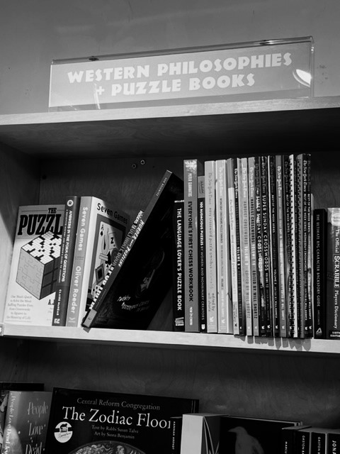
An odd juxtaposition of categories and somewhat ironic. Is that a commentary? Book store in St. Louis (Left Bank Books).

DSCN4597ab

Las Vegas, NM. The Hotel Castaneda (1898) was the first railroad Harvey House Hotel. Largely vacant and neglected for half a century, it is now restored and back in business thanks to the efforts of an enterprising local restoration advocate. He actually operates three restored hotels now, two in Las Vegas. My room at the Castaneda was quiet and comfortable and well supplied with everything I needed. The bar and restaurant were nice and friendly. 


DSCN4586b

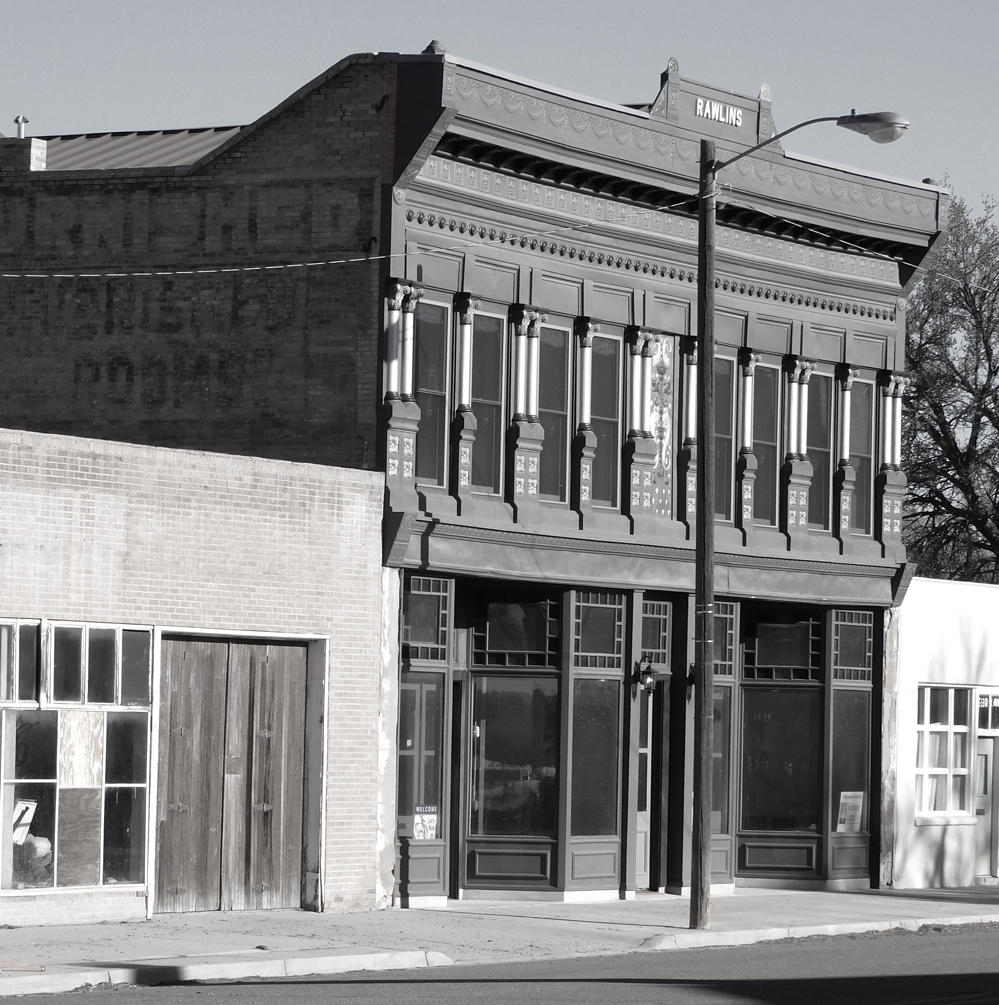
Restoration of one structure often ripples through the neighborhood. The Rawlings Building served as the rooming house for the crew of Harvey Girls that worked in the Hotel Castaneda, across the street.  The restoration and preservation seeds found fertile soil and are well rooted in Las Vegas. There are over 900 structures on the historic register. The town is a magnet for movie filming locations.

DSCN4608ab

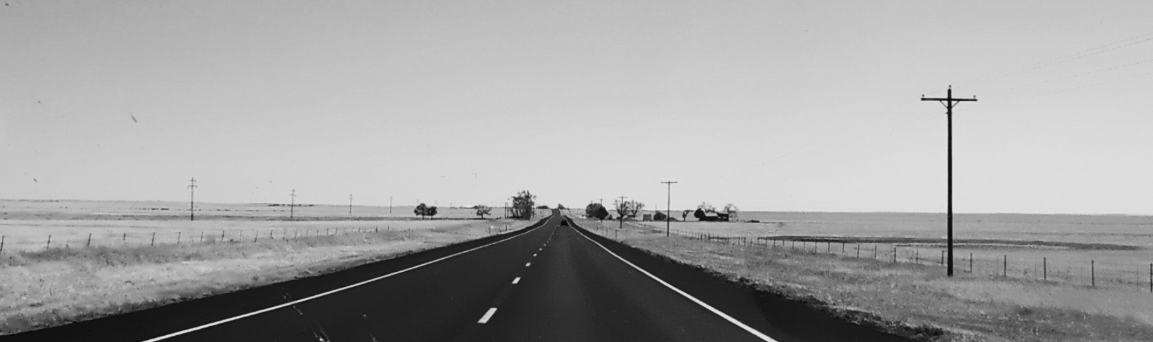
Western Kansas — the high plains. One can be absolutely alone out on the western blacktop highways. I was essentially following the old Santa Fe Trail, now 200 years old. 

IMG_0042b

Ellinwood, Kansas is a wide spot in the road halfway across the state with around 2000 residents. It was settled in 1872 along the Santa Fe Railroad. This was also on the route of the Santa Fe Trail and the area saw a lot of pioneer travelers heading west in the early days. I was surprised to see well preserved brick side streets in residential neighborhoods. The sound of a car driving on a brick pavement is mostly lost. Ellinwood has some notoriety as the birthplace of the 1970s “Kansas” rock group’s rise to fame (Dust in the Wind). 

IMG_0044ab

Ellinwood’s Wolf Hotel, opened in 1894, is on the historic register and serves as a hub of local activity. My rooms were just above the front door. There is a little enjoyable quirkiness to the place, thanks to the current owner.

DSCN4639b

Hell on the river. The massive Missouri State Penitentiary in Jefferson City was opened in 1836 and closed in 2004. It housed captured abolitionists, Confederate Civil War prisoners, “Pretty Boy” Floyd, “Sonny” Liston, Emma Goldman, “Kate” Richards O’Hare, and James Earl Ray, among many thousands of others. 

DSCN4636b

The old prison administration building.

DSCN4637b

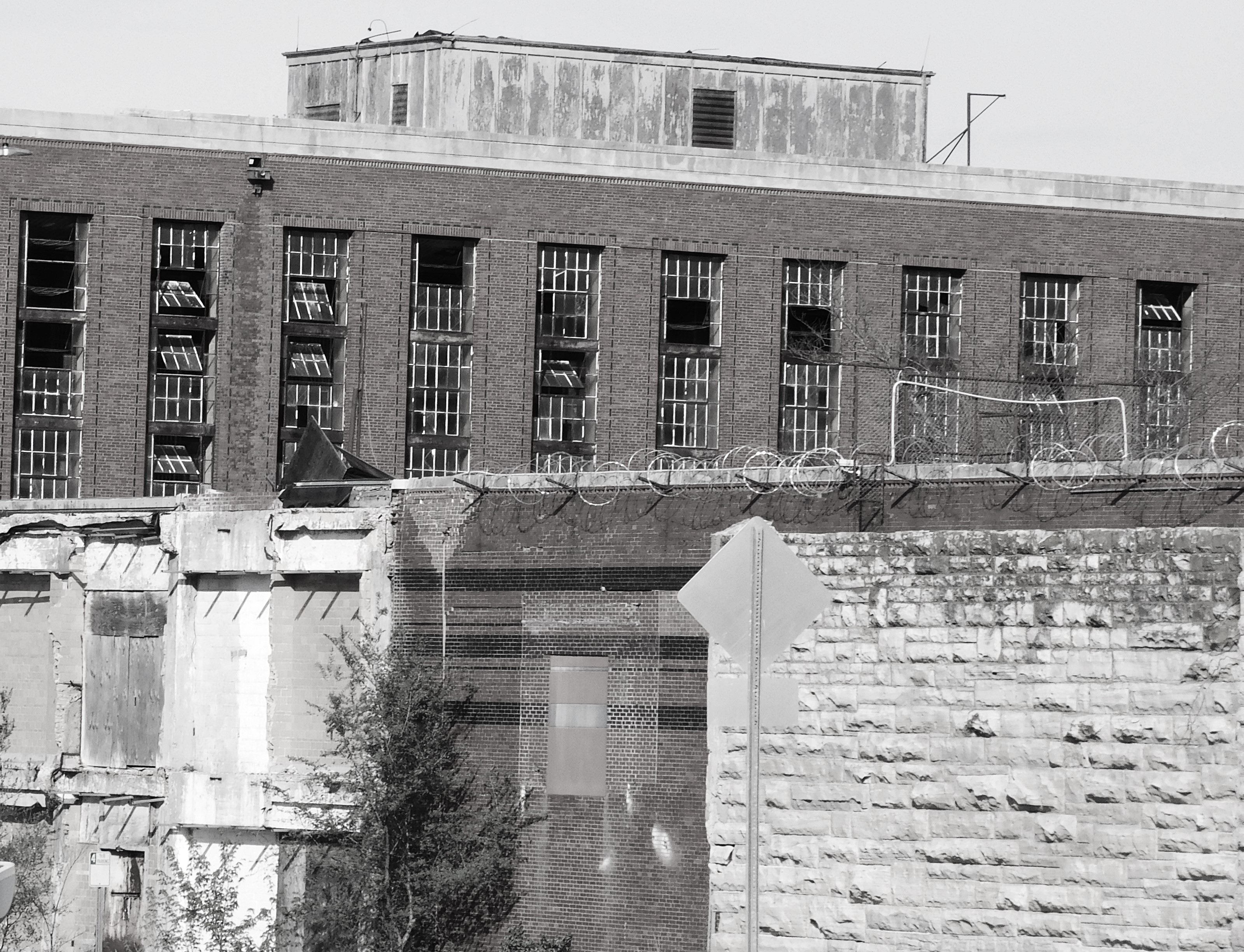
The complex is sitting idle but has become a popular tourist attraction. There are billboards on the interstate advertising prison tours. There are stories of ghosts in the prison, but I used to work in there on occasion and it was much scarier when filled with inmates. I understand that the gas chamber is a hit with the tourists. I find no joy in that. I still recall the sounds and the disinfectant smell of the place. The prison was built on a bluff over the Missouri River, hence the “Hell on the river” label.

DSCN4641b

The prison wall still stands along Lafayette Street but has now collapsed in a few other spots due to neglect. My office was in the stately brick “Director’s Residence” that served as the administrative offices in the 1980s. Guard towers were situated along the wall. 

DSCN4841b

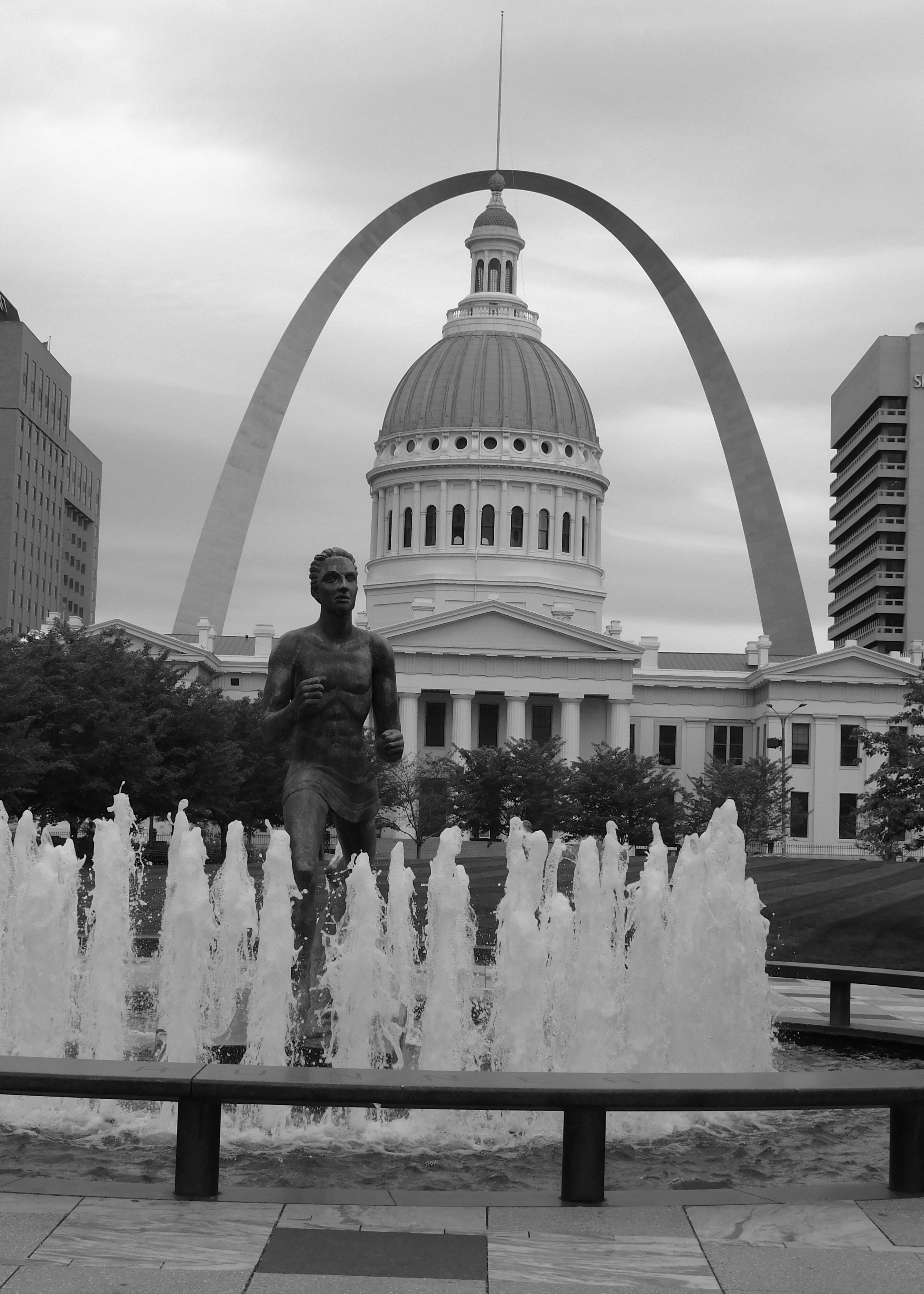
Saint Louis was founded in 1764 by the French and grew from a frontier village to the bustling “Gateway to the West” in time for the western expansion and the popular notion of “Manifest Destiny”. Lewis and Clark presided over the transfer of the town to American control from the Spanish and French just before starting off with the Corps of Discovery in 1804 on their trek to the Pacific Ocean. St. Louis fell under the authority of three flags in one day. The “Old Courthouse” was constructed in 1839 and remodeled somewhat in the 1850s. Its eastern steps served as the site of slave auctions and the Dred Scott court case was first heard here. An old cupula was replaced by the current cast iron and copper dome in 1864. The building is an architectural jewel with an ugly past leading up to the Civil War.

DSCN4827b

The Illinois side – and a small towboat pushing a coal barge down the Mississippi. Towboats are really pusher boats… go figure.

DSCN4823b

St. Louis grew up on the Mississippi River just a few miles south of the confluence with the Missouri River. There is still a great deal of river traffic. The granite cobblestone levee was the landing for hundreds of steamboats moored four or five deep and carrying products and people into the American west. Some of my German ancestors arrived by steamboat from New Orleans in the 1840s.

DSCN4822ab

The Eads Bridge is a masterpiece of American bridgebuilding. Construction started in 1867 and it opened in 1876 and was the first bridge across the Mississippi River below the confluence and now is the oldest existing bridge over the river. The bridge carried rail traffic as well as vehicles (horse carriages then automobiles).  It was designed to last 1000 years and is still going strong at almost 150 — it is working on it. The 1951 Martin Luther King Bridge is in the background. The 1917 Veterans/MacArthur Bridge is some distance to the south and is decommissioned and partially demolished. The Eades Bridge stands out as a thing of beauty. It is named for its builder, James Buchanan Eads.

DSCN4814b

The major modern engineering marvel is the Gateway Arch rising 630 feet into the sky on the low bluff above the river. The arch largely occupies the footprint of the original village of St. Louis. On the day I visited there were several Buddhist monks lined up for a ride to the top. The ride is not designed for claustrophobic passengers. The arch is fifty years old already and I can remember when it was topped off with the final “keystone” segment in 1965. The designer-architect, Eero Saarinen, didn’t live to see it completed. 

I didn’t go up in the Arch. I have been there. I did pretend to be a new tourist and went places that I have never been even though I was raised in this city. We all have sort of a list of things to see or do in our hometown but never get around to actually doing them because we figure we will do it eventually. Well, I got out my list and checked off a few things. I will just quickly run through some of these spots.

The first one is an exception to what I just said. I almost always make a pilgrimage to the Missouri Botanical Gardens, locally known as “Shaw’s Garden” after Henry Shaw, a one-time English immigrant who got off of one of those riverboats at the landing and made himself a multi-millionaire in the growing city. He was extremely wealthy and had little to spend his money on, so he became a world-class botanist. He created the best botanical garden in the US and perhaps one of the top three in the world. Of course, the place is full of color, but I’m sticking to black and white images.

DSCN4755b

The mid 19th century botanical library housed Shaw’s collection of notes and reports from research and expeditions sent out to all parts of the world. It still is a center for advanced botanical study and research.

DSCN4773b

The Climatron was completed in 1960 and renovated in 1988. It was the first fully enclosed, climate controlled, geodesic dome greenhouse. The inside about 50 yards across, contains several lowland tropical ecological zones. You can get momentarily lost in there with the scents and sights of tropical vegetation.

I had never been to the main and largest Anheuser-Busch brewery. Okay, I knew it was big but there are cities that are smaller. I was truly surprised at the scale. This is the original brewery dating back to 1875. The old buildings have been renovated and repurposed over the years and are still part of the main operation. The old sits next to the new.

DSCN4700b

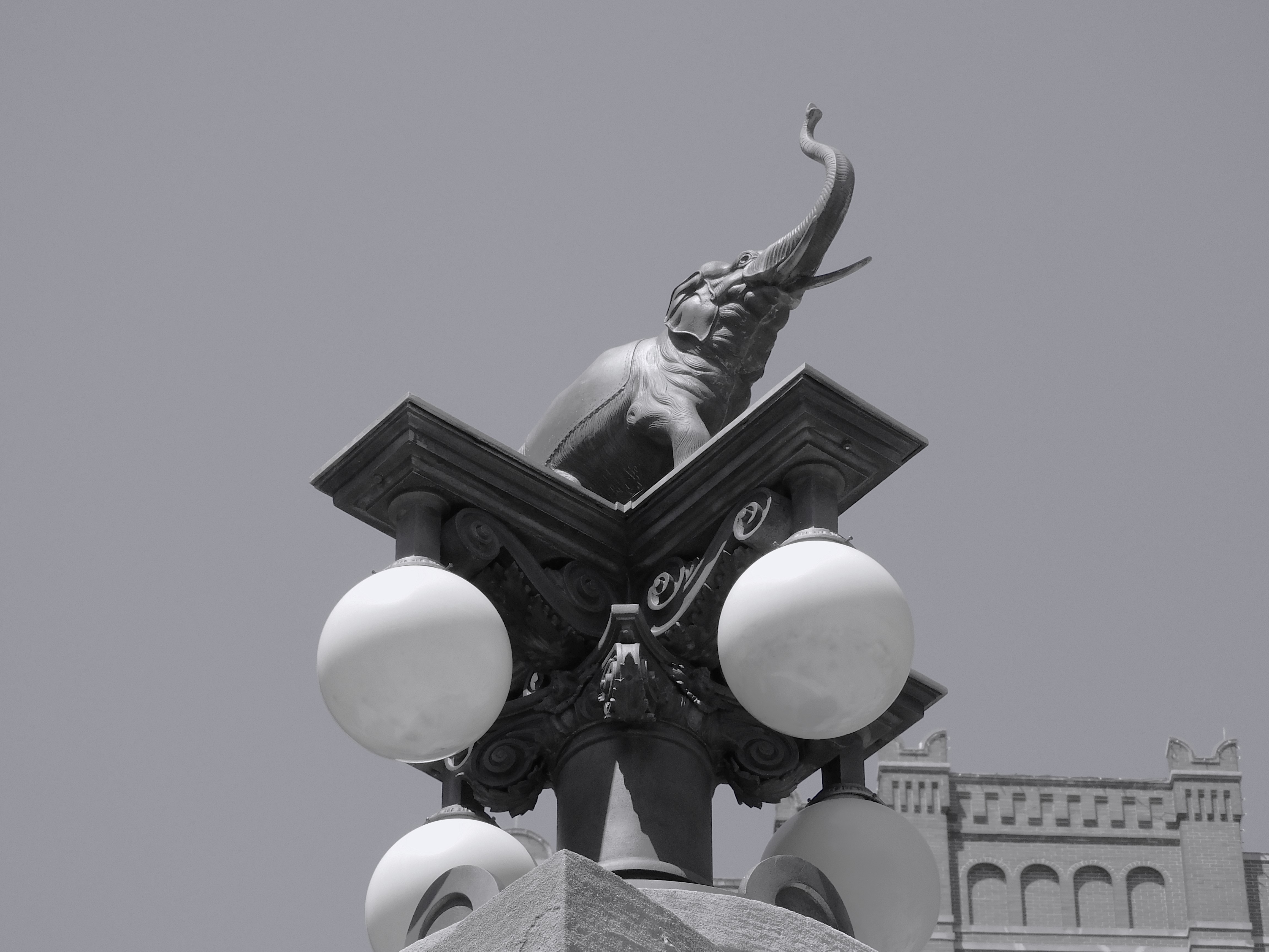
Back in the day, it was normal to include various touches of artistic architecture or whimsical decorations. The Elephant streetlight is just one example.

DSCN4713b

I also had never visited the main Roman Catholic Cathedral Basilica in St. Louis. This is the “new” cathedral not to be confused with the “old” cathedral located near the riverfront. I had been to weddings at the old cathedral in years past but never set foot inside the newer one.

DSCN4672b

 This is the Cathedral Basilica of Saint Louis, completed in 1914. It may be new but still over 100 years old. It has a mostly Romanesque exterior design, but the interior is almost entirely Byzantine.

DSCN4652ab

The structure is huge. The St. Mark’s Cathedral in Venice would fit inside of it. You are overwhelmed by the size and the tremendous mosaics covering the interior surfaces.

DSCN4657ab

You really can appreciate the place on a smaller level. I looked for smaller views instead of trying to capture the entire structure.

DSCN4675ab


The Cathedral is located on Lindell Blvd. in an area known as the Central West End. That “trendy” area is not too far from Washington University, St. Louis University, and Forest Park. There are some interesting things to see. At the corner of Euclid and McPherson you will find Left Bank Books, the oldest independent bookstore in St. Louis. It is possibly the literary heartbeat of the city. The street corners honor some of the city’s literary heroes.

IMG_0076b

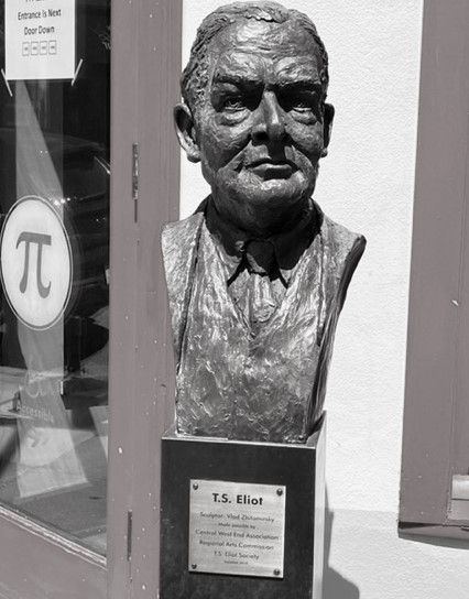
The poet T.S. Elliot was born in St. Louis, not too far from his bronze bust outside the local pizzeria.

DSCN4796b

“Tennessee” Williams also lived and worked in St. Louis in the general area. My aunt was acquainted with him and helped stage his first plays by a local drama group called “The Mummers”. By her accounts he was a memorable character even then though something of a drama queen.

William S. Burroughs and Kate Chopin are also represented there, suspiciously eyed by “Tennessee” Williams from across the street while Elliot seems to wonder what he is doing in front of a pizza shop.

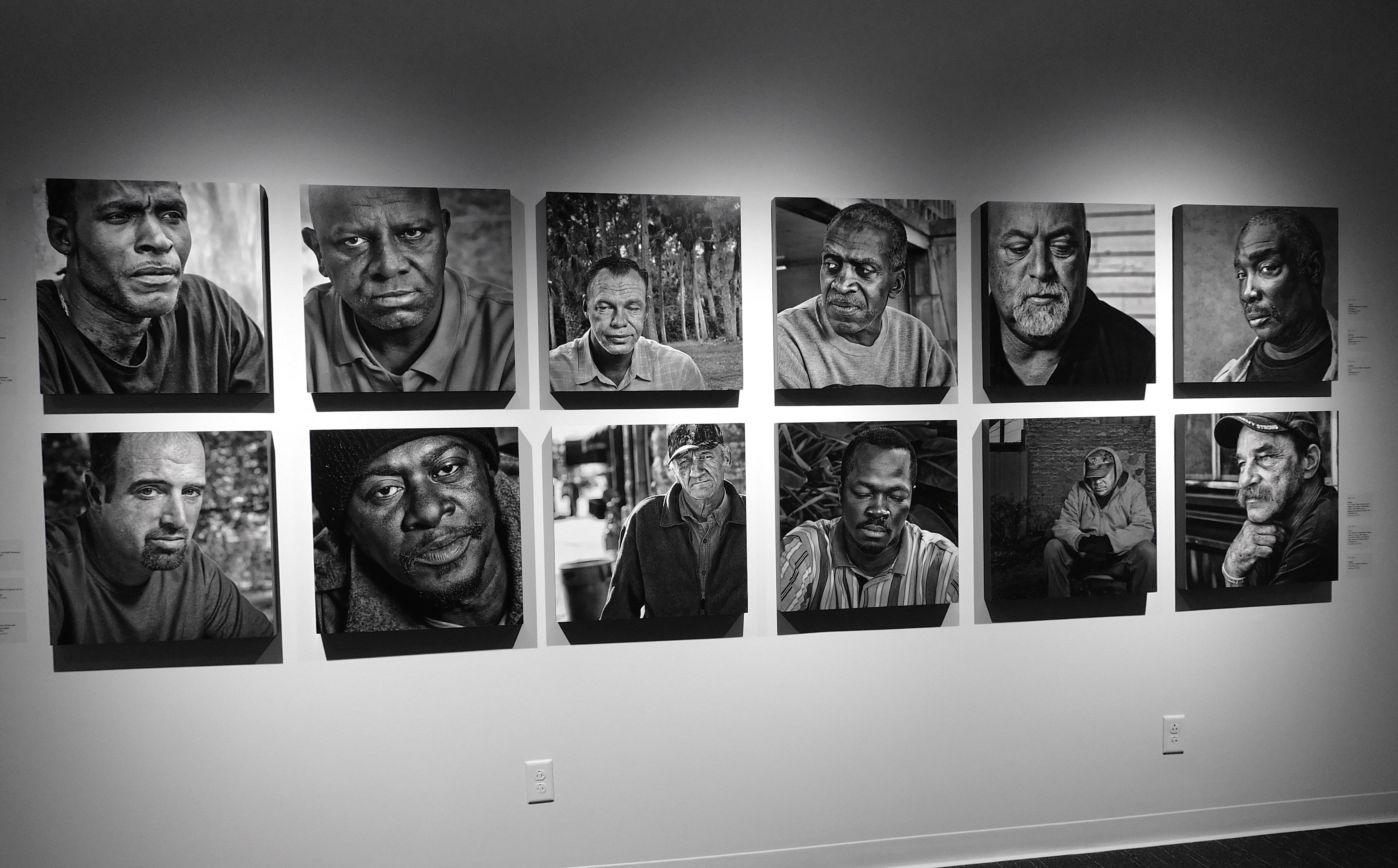
Also in this general area, closer to St. Louis University, is the International Photography Hall of Fame. I admit that I didn’t know that it was there, but it was a fabulous find.  The public exhibit was of photographic images and short profiles of homeless veterans by Jerry Tovo.


DSCN4861b

Each photo was very moving, and you get some idea of how these people fared while in the military, what their assignment was, and, in some cases, how they ended up homeless and on the street.  

DSCN4856b

The nephew’s wedding came off without a hitch although the happy couple both had COVID up to a couple days before the ceremony. They intended to get married in hazmat suits if they had to.  We started our road trip home the next morning. We were tired of traveling and just followed the interstate home. This interstate route was following Historic Route 66, turning 100 years old in a few years. There were a few obligatory stops along the way.

In western Oklahoma I often visit Lucille’s Roadhouse, an early stopping point along the old highway. It seems to have had a nice makeover since my last visit — new paint and some repairs. Lookin’ good.

IMG_0122b

There were some old run-down tourist cabins out back that also have been renovated. Such was the state of travel by car in the early 1930s. It is simply a roadside memorial to the old highway, not in business. There is a new Lucille’s a few miles ahead where we stopped to eat some last Midwestern food.

 Our next stop was near Amarillo in the Texas panhandle. We found the “Bug Ranch”, a take-off of the more famous “Cadillac Ranch” but made of old rusting Volkswagen “Bugs”.

DSCN4889 - Copyb

This is located at the highway exit for Conway, Texas…east of Amarillo.

Close by, on the western side of Amarillo is the world-famous Cadillac Ranch. This is where you might meet a busload of Chinese tourists or some Dutch or German folks on Harleys or some Brits in a rented van. You can smell the spray paint from the highway. Sometimes there is a food truck parked on the side of the road.


DSCN4901b


The paint is so thickly applied over the years that it tends to melt in the hot Texas summers forming small paint-sicles.

We were happily and safely home the next day.

On reflection, one of the best “new to us” places we found was the Spine Indie Bookstore & Cafe on Arsenal Street next to Benton Park in St. Louis. It only deals in independent published books. They have special readings scheduled and some music performances. The coffee and hot chocolate is great as well as the muffins. If you go, save some time to stroll around Benton Park and look at some of the stately old homes.

SPINE Google_b

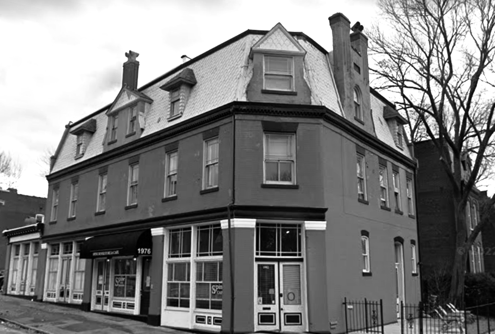
All of the photos are mine except this last one that I borrowed from Google because I forgot to take a picture of the place.   

     *     *     *     


.


2021 Remembered

I decided to take a few minutes to review 2021 in pictures…. That proved to be a much larger task than I first thought.

These selections are more or less in chronological order with a short label or comment on the image or the day it was taken.

Waldo Canyon Road — January 2, 2021. We were suffering from pandemic cabin fever (a recurring theme this year) and decided to get out of the house and head over toward Madrid NM on the mostly unpaved Waldon Canyon Road. A landowner found an innovative way of using old tires to post “No Trespassing” signs.

DSCN2493 (3)

Near Cerrillos NM — The same day we took a wrong road leaving the little village of Cerrillos and found this gem of an old pickup truck. It looked to be well cared for but was sitting out in a field. You often find old cars sitting out in fields that look in pretty good shape for their age. They say that humidity is so low in New Mexico that nothing rusts. That is not totally true.

DSCN2511 (2)

Rio Grande – Siphon Beach — We took a mid-winter walk in February along the trail that follows the Bosque Forest along the Rio Grande. This is Siphon Beach where a weir is constructed across the river to maintain a water level of a certain height. We use an ancient irrigation system here that diverts water from the Rio Grande through acequia canals that send water to agricultural fields. Surplus water is returned to the river and used in irrigation systems downstream. This system was introduced into Spain by the Moors from North Africa and then used in Spanish colonies. The Pueblo Indians had similar irrigation canals. DSCN2744 (2)

Floaters in February — Siphon Beach is a put-in point for floaters on the Rio Grande. 

DSCN2745 (2)

Resident Lizard — Spring has sprung and the resident lizards are soaking up rays. They have to be vigilant to watch for the Roadrunners. This guy is in my courtyard and fairly safe.

DSCN2820 (2)

Sandia crags — One of many photos I take of the Sandia Mountains directly across the Rio Grande valley from my house. I have a good view from my porch where I shoot most of these pictures. On this day the clouds and setting sun were alligned in a way that set off the sharp crags of the Sandias’ western slope. Some cliffs ate 800 feet high.

DSCN2585 (2)

Camposanto – Fairview Cemetery, Albuquerque — We visited the old Fairview Cemetery in Albuquerque that is the final resting place for thousands of local people over the years. There is one section for military graves — regimented even in death in straight and stoic lines. The Hispanic graves are located nearby and display a wide array of decorations and are frequently tended, raked, and redecorated by family members. In general, there is not much grass in New Mexico cemeteries, which serves as a major difference from what I was used to in the Midwest. There is a large section of this cemetery that is covered in grass and shade trees. Some of the prominent families are buried there. One interesting section was apparently an area designated as a plot for members of the Bahai faith. I was not aware that we had a Bahai community in Albuquerque. This is a city cemetery. Country cemeteries, called Camposantos, are interesting and well maintained.

DSCN2785 (3)

Fairy Chimneys and Goblins – Jemez Mountains — One of my favorite walks this year was to explore the Goblin Colony up in the Jemez Mountains. I was not sure what to expect and it left me speechless when I got there. It was not an easy hike down a steep gravelly and forested slope. you have to descend from one tree to the next to stay upright in the loose soil. The Jemez Mountains are volcanic relics of a super volcano that rose up and collapsed into its magma chamber three different times over millions of years. The volcano covered the area with thick deposits of ash that solidified into Tuff, a sedimentary rock of igneous origin. Tuff, being made of ash, is fairly soft but it erodes into strange shapes. These vertical shafts are called Fairy Chimneys. The tallest one is probably 20 feet tall. These are all natural formations.

DSCN3319 (2)

Goblins on parade — The same slope has hundreds of Goblins, mostly facing downhill as if they are watching something. You can imagine distorted facial features on the stone formations.  There is no real marker for this place. You just have to know that it is there.  A lot of New Mexico is like that. DSCN3309 (2)

Rio Grande Gorge — In the spring, spurred on by pandemic cabin fever, we headed up to Taos and spend a week exploring the Rio Grande del Norte National Monument, one of the country’s newest monuments. The Rio Grande flows through a gorge that cuts a 700-foot-deep trench through the Taos Plateau. Driving across the plateau, you don’t see the gorge until you are almost at the edge.

DSCN3046 (2)

Rio Grande Gorge Bridge, Taos — the highway running west from Taos crosses this modern bridge. It would have been a difficult crossing before the bridge was built. Sadly, this is a notorious suicide site and there are counselling hotline phone installations on the bridge.

DSCN3263 (3)

Earthship — We stayed at the Biotech Earthship community for a couple nights when in Taos. These are sustainable homes — mostly or entirely “off the grid”. It was very interesting and educational. They have AirBNB rentals for a few visitors. 

DSCN3150 (2)

Gallisteo Basin — South and east of Santa Fe is the Gallisteo Basin Nature Preserve. It is an area set asside for hiking and outdoor education purposes. The view is toward the southeast and away from the mountains that rise to the right of the picture. The Ortiz Mountains and the Sandias rise up between here and Albuquerque. We picked a day punctuated by spring thunderstorms.

DSCN3343 (2)

Rio Rancho Outback — Another place that you won’t know about unless you are told or hear rumors is the open lands to the west of Rio Rancho, the town of 100,000 people adjacent to Albuquerque. Rio Rancho is the third largest city in the state, but few people have heard of it. This undeveloped area is below a steep escarpment slope going down into the Rio Puerco valley. The Rio Puerco is mostly dry, but it once supported a number of Pueblo communities. The elongated mesa (Mesa Prieta) in the distance has several Indian petroglyph sites. The area is part of the Zia Pueblo lands or several large private ranches.

DSCN2821 (2)

Sandias at sunset — Here is another sunset view of the Sandias. The granite includes a large amount of feldspar crystals that reflect red in the sunset. Dust in the air at sunset can give it an orange tint. Sandia is the Spanish word for watermelon.

DSCN2777 (2)

Ojito Wilderness — West of Albuquerque, near the town of San Ysidro, is the Ojito Wilderness. This view is looking east toward the Sandias.

DSCN3682 (2)

Moonrise over Sandias — The moonrise is sometimes quite spectacular as it pokes itself over the top of Sandia Mountain. The full moon actually rises at different places each month in a multi-year cycle. you have to time the photo at the right time on the right day.

DSCN3716 (2)

What are you looking at? — I have a Goldfish Pond that attracts various kinds of wildlife including these large Dragonflies. This one looks like he is giving me the eye — “what do you want?”

DSCN3480 (2)

Backyard visitor — Among the visitors in my yard are several hawks. This is the smaller one. He might be a young one. I have plenty of live food for hawks and Roadrunners of other predators. I usually have three or four Gambels Quail families with a combined count of 20-30 chicks. 

DSCN3850 (1)

Ojito Wilderness — Another trip out to the Ojito Wilderness to visit the sandstone Hoodoos.

DSCN4235 (2)

Hoodoos at Ojito Wilderness — The wilderness is known locally as the place where the dinosaur bones are often dug up.

DSCN4255 (2)

Mesa Verde — In October we decided to take a big circle trip up into Colorado and Utah. This is a view of one of the cliff houses in Mesa Verde National Park.

DSCN3893 (2)

Canyonlands — We also visited Canyonlands National Park.  This is the Green River flowing south toward its meeting with the Colorado River.

DSCN3977 (2)

Gates of Lodore at Dinosaur National Monument — Another view of the Green River, this time flowing into the canyon named the Gates of Lodore by John Wesley Powell. The Green River picks up water from the Yampa River and flows south into Canyonlands.

DSCN4057 (2)

Great Sand Dunes — This is one of my favorite photography sites. The sand dunes pile up as much as 800 feet. You can see the ant-like people that have climbed to the top of the far dunes. The dune shapes change and show different colors at every visit.

DSCN4161 (2)

Great Sand Dunes — The shifting sand dunes pile up against the mountains.

DSCN4155

Inner light – Sandias — The Sandias are the eastern edge of a huge rift valley that is home to the Rio Grande River. The rift begins in Colorado and continues south to Mexico. It is several miles deep and filed with sand and rubble from the eroding mountains. In this December picture, the setting sun and the broken cloud cover conspired to enlighten a valley between the two major ridges.

DSCN4308 (2)

–<>–

The Santa Fe Trail – 200 Years Ago

This year marks the 200th anniversary of the Santa Fe Trail that connected traders in Missouri to Santa Fe. My wife had an ancestor who was a mule skinner on the Santa Fe Trail, and we retraced much of the route.  I returned a couple years ago to fill in the missing parts.

Although there were a few tentative trips to Santa Fe by French traders from Kaskaskia and St. Louis even in the 1700s, the actual Santa Fe Trail originated in 1821, from Arrow Rock, Missouri, on the Missouri River and then moved further west to Independence and Westport/Kansas City.  That was newly settled country along the rolling hills south of the river. In later years, it started at those places once the river traffic proved reliable in shipping goods to the west. The trail continued through the Civil War and up to the arrival of the railroad.

590_3599

Of course, once the wagons hit the plains of Kansas the scenery became truly expansive. The plains stretch out forever and you have a sense that you are inside of a shallow bowl looking out to the edges in the far distance. That view was better than the hind end of an ox or a mule, which was mostly what else there was to see.

After a few hundred miles the trail began to follow the Arkansas River. One of the landmarks was Pawnee Rock, now a small town in Kansas. The actual rock was a notable sandstone protrusion that could be seen from a distance. It was described as one of the finest sights ever beheld by man. Really? Having visited Pawnee Rock, I would say that it is a considerably better sight than the rear end of an ox. Perhaps prairie madness was beginning to set in.  Sadly, the rock was partially demolished by the railroad, so it isn’t quite as tall as it once was.  The train doesn’t stop at Pawnee Rock anymore, so a few years ago they converted the station to the town library.  That is an old pioneer grave marked on the slope of Pawnee Rock.

The route follows the Arkansas River. I apparently did not find the river very photogenic since I never took a single photo of it in my several trips along the trail.

The Santa Fe Trail saw a lot of activity during the American/Mexican War in 1846-48. In 1846, General Stephen Kearny led troops from Fort Leavenworth down the trail to New Mexico. Kearny took possession of Nuevo Mexico for the United States in a proclamation at Las Vegas (NM) and then continued to on take possession of Santa Fe. There was no real opposition. The Mexican Governor, Manuel Armijo, was in no position to put up a defense. He was probably more interested in continuing trade than defense. Mexico City was very far away. The main sticking point seemed to be one of religion and Kearny was quick to underscore the notion of freedom of religion in the US and that Catholicism would not be threatened.

The annexation of New Mexico Territory opened up more trade, but the Plains Indians still threatened commerce. Several army posts were established along the route. Fort Larned was a major stop along the trail. It was established in 1859 to protect the wagon trains on the middle Kansas part of the trail. It is well preserved today as a national historic site. We have images of Fort Apache from old toy sets or maybe television shows. Fort Larned never had any walls. It had some defenses from a creek that ran by, but you could pretty well see anyone coming from a distance.

The buildings are constructed of local sandstone and have served as a convenient place for soldiers or visitors to carve their names or the names of their wives or girlfriends in the stone. The fort was decommissioned and taken over as a ranch for several decades before becoming a historic site.

OLYMPUS DIGITAL CAMERA

Fort Larned is one of the several places along the trail where you can still see the wagon ruts. There was a lot of wagon traffic and, unlike what we see on TV, the wagons did not move in single file. The wagons moved several abreast, so the ruts are not a single deep impression but a series of elongated swales almost as wide as a modern highway. They are not easy to see in the grass unless you walk out into the prairie.  (That’s me at a much, much younger age.)

The trail continued west along the river past what became Dodge City (Ft. Dodge) and crossed into what became Colorado. The next stop was Bent’s (Old) Fort near present day La Junta, Colorado. The Bent brothers operated the fort as a trading post and a way station for the Santa Fe Trail traders. The historic site is a reconstruction of the original fort, made of adobe. It actually conforms to what we think of as a fortress.

The Bents were essentially the last “eastern” outpost on the trail. The proprietors, Charles Bent and William Bent and Ceran St. Vrain, established a trading company that built the fort in 1833. It was destroyed in 1848, possibly as a result of a devastating cholera epidemic among the Indians, and later reestablished at a location near present Lamar, Colorado.  Charles Bent was named Territorial Governor of New Mexico and moved to Taos but was assassinated during the Taos Revolt of 1847.

Going west from Bent’s Fort the traders were approaching the Rocky Mountains. The terrain was still relatively flat, but the elevation had been steadily rising. The taller grass gave way to the shorter stubble and buffalo grass of the high plains.  The front range came into view on clear days. The two Spanish Peaks were the first mountains that they saw close up, but they would then climb up and over Raton Pass, at 7,834 feet, and cross into New Mexico.

590_3603

The terrain was much different in New Mexico. The trail skirted the east side of the Sangre de Cristo mountains. There were small Hispano villages in places. Cimarron was established in the 1850s and later had a notorious wild west town reputation. It had an established mill (the Aztec Mill) in the 1860s that still exists today. Later on, Abraham Lincoln’s White House chef, Henri Lambert, established a large hotel (now the St. James Hotel) that was frequented by everybody who was anybody in the old west. There were 22 murders in and around the hotel, which, of course, is haunted.

Further west the wagon trains pulled into Fort Union, a huge military depot that housed 4,000 soldiers and suttler/merchants that catered to the travelers’ every need. Fort Union was initially established in 1851 but enlarged and rebuilt three times. The national historic site includes the ruins of the second fort, built of adobe but now mostly melted away. The fort remained in service until 1891. Visiting the fort can be a somewhat spooky experience on a foggy day with a few snow flurries.

There was a hospital at the fort that provided medical attention. Blacksmith and wheelwright shops worked on the wagons. Supplies were bought for the last leg of the trip. The wagon ruts are still visible where the trail entered into the fort.

The wagons were beginning their approach to Santa Fe, only a few days more on the trail. They passed other landmarks, like Wagon Mound and Starvation Peak. They crossed the Pecos River, not much of a river as it flows out of the mountains. The mostly abandoned Pecos Mission and the Pecos Pueblo were located there. The old Pueblo was where Coronado was told about the city of riches, Quivera, that existed out on the Great Plains. In 1541, he roamed across Kansas looking for it and got as far as the vicinity of Salina before it dawned on him that he had been told a tale just to get him out of town. Later a large Spanish mission was constructed at the Pueblo and the residents were more or less pacified — for a while. The mission was destroyed during the 1680 Pueblo Revolt that forced the Spanish out of New Mexico for over a decade. On their eventual return, the Spanish constructed a smaller mission church and the community coexisted for almost a century until disease and attacks by the Apaches drove most of the residents away. By 1838 it was abandoned. Only the earliest Santa Fe traders found any permanent residents.  Much like Fort Union, the adobe walls are slowly melting away after 200 years.

Also, on this last stretch of the trail the route goes over Glorieta Pass, the divide between the Pecos and Rio Grande rivers. During the Civil War there was a battle fought here between Union Troops, some from Ft. Union, and Confederate invaders from Texas. The rebels were sent packing back to Texas. There are historical markers in the area, and I think an old bridge that survives from the time of the Battle of Glorieta Pass. This was one of the westernmost battles of the Civil War, albeit not a huge one.

The next stop is Santa Fe.

By now you probably feel that you have actually made the trip.

Don’t relax. You have to unload the wagons, make new purchases, and start the trip back. The weather is turning.

cropped-p8300036-1.jpg

     *     *     *

Rio Grande del Norte

Rio Grande del Norte National Monument is one of our newest monuments, located near Taos, New Mexico. The Rio Grande is a wild and scenic river flowing through a deep gorge. What I find most striking is the solitude and quiet of the place (with some exceptions). This is simply a photo collage of scenes from a recent trip in May 2021.

The Taos plateau is a flat expanse of desert to the west of Taos NM and the Sangre de Cristo mountains, the tail end of the Rockies coming out of Colorado, rise to the east. Driving west out of Taos the plain seems featureless except for the distant peaks from extinct volcanoes. Then, suddenly, the bottom falls out — the gorge is revealed almost without warning.

We visited on a stormy Monday and several times over the next few days and followed the gorge north toward the confluence with the Red River Gorge near Cuesta.

You might remember the bridge from one of the Terminator movies. Sadly, it is a site marred by frequent suicides and there are a half-dozen crisis intervention call boxes positioned on the bridge. There is a popular rest area by the bridge with a few trails along the west rim. There was a flock or harem of Big Horn Sheep near the rest area. It is lambing time but no lambs yet.

The lower gorge is a popular river rafting area because the river is more accessible and the highway runs along side offering several places to put in and take out. To the north, near Cuesta, the National Monument is a solitary place with few weekday visitors. We had the place to ourselves with no other person within miles as far as we could tell. There is no human noise — simply the wind, the sound of the rapids so far below, and occasional bird calls. Hawks soar past on the rising thermals. The native Juniper trees are 2000 years old, or more. Pinon Pine trees drop their pinecones providing pine nuts for a few squirrels. There are occasional ancient trails where the Big Horn Sheep have been climbing down to drink at the river for thousands of years. The gorges — two of them converging — command attention but the Sangre de Cristos and the distant volcanoes dominate the far horizon.

This is a remote place — not easily found. There are no concession stands. No grand hotels. No tour buses. There are camping sites and hiking trails. You have to want to be here and willing to make an effort. Little has changed here in ten thousand years,